|
search place name
|
||
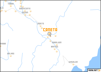
Caneta (Nueva Ecija, Philippines)Caneta is a town in the Nueva Ecija region of Philippines. An overview map of the region around Caneta is displayed below.
regional and 3d topo map of Caneta, Philippines ::
Caneta airports ::
The nearest airport is MNL - Manila Ninoy Aquino Intl, located 112.5 km south of Caneta.
Other airports nearby include BAG - Baguio (123.7 km north west), Nearby towns ::
Bugnan (0.0km north) //
Bagong Sikat (1.1km west) //
Bitulok (1.9km south) //
Malinao (1.8km east) //
Dupinga (2.6km north west) //
Gabaldon (3.9km south east) //
Ligaya (4.3km north west) //
Bantug (5.1km south) //
Lanete (5.1km north west) //
Irorolong (6.1km south) //
Bagting (10.8km north west) //
[all distances 'as the bird flies' and approximate] 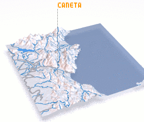 Places with similar names to Caneta, Philippines ::
Disclaimer :: Information on this page comes without warranty of any kind |
||
|
Where is Caneta? Elevation and coordinates ::
Latitude (lat): 15°29'0"N Longitude (lon): 121°19'0"E
Elevation (approx.): 122m (map arrows pan, magnifying glasses zoom) |
||
|
Visiting Caneta? Hotel/Accommodation ::
Book a hotel in Caneta Travel Guide ::
Buy a travel guide for Philippines rental cars ::
car rental offers GPS waypoint ::
download a GPX waypoint (PoI) of Caneta for your GPS receiver
|
||