|
search place name
|
||
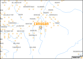
Caniogan (Ilocos Norte, Philippines)Caniogan is a town in the Ilocos Norte region of Philippines. An overview map of the region around Caniogan is displayed below.
regional and 3d topo map of Caniogan, Philippines ::
Caniogan airports ::
The nearest airport is BAG - Baguio, located 172.5 km south of Caniogan.
Nearby towns ::
Macayepyep (1.0km west) //
Nueva Era (1.7km south) //
Padpadong (1.9km south) //
Pauer (1.8km east) //
Bangsar (1.8km east) //
Barikir (1.8km east) //
Caraoca (1.8km east) //
Tanap (1.9km east) //
Ambagsang (2.6km north east) //
Lading (2.7km north east) //
Caldaan (3.7km north) //
Binacag (3.6km south west) //
Nagpatayan (3.8km north west) //
Cabulalaan (4.1km north east) //
Papadog (4.0km north west) //
San Juan (4.1km north west) //
Paor-Patoc (4.3km east) //
Balioeg (4.9km north east) //
Garnaden (5.1km south west) //
Pusuac (5.1km north west) //
Espiritu (5.6km north) //
Bumitog (5.4km west) //
Bugayong (5.6km west) //
Ambagsang (5.8km north) //
San Gregorio (5.8km north) //
Capacacan (5.8km north) //
Binacag (5.8km north) //
Bingao (5.6km east) //
Santo Niño (5.8km north east) //
[all distances 'as the bird flies' and approximate] 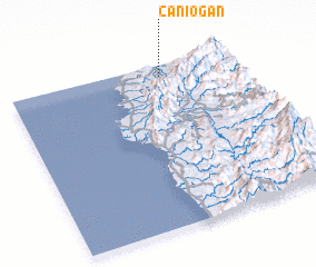 Places with similar names to Caniogan, Philippines ::
Disclaimer :: Information on this page comes without warranty of any kind |
||
|
Where is Caniogan? Elevation and coordinates ::
Latitude (lat): 17°56'0"N Longitude (lon): 120°40'0"E
Elevation (approx.): 92m (map arrows pan, magnifying glasses zoom) |
||
|
Visiting Caniogan? Hotel/Accommodation ::
Book a hotel in Caniogan Travel Guide ::
Buy a travel guide for Philippines rental cars ::
car rental offers GPS waypoint ::
download a GPX waypoint (PoI) of Caniogan for your GPS receiver
|
||