|
search place name
|
||
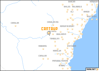
Cantaup (Negros Oriental, Philippines)Cantaup is a town in the Negros Oriental region of Philippines. An overview map of the region around Cantaup is displayed below.
regional and 3d topo map of Cantaup, Philippines ::
Cantaup airports ::
The nearest airport is DGT - Dumaguete, located 70.4 km south of Cantaup.
Other airports nearby include BCD - Bacolod (80.5 km north), ILO - Iloilo (104.2 km north west), NOP - Masbate Mactan Cebu Intl (107.9 km north east), SJI - San Jose Antique (155.3 km north west), Nearby towns ::
Nayhang (1.3km east) //
Matagub (2.7km north east) //
Tambulan (3.0km south east) //
Casoloning (4.2km north) //
Cambaye (4.3km east) //
Tambo (4.4km south east) //
Budlaran (4.6km east) //
Suquib (5.1km east) //
Nabhang (5.6km south west) //
Amdus (5.9km south east) //
Mongaybongay (7.1km east) //
Lonao (7.2km east) //
Tubod (7.5km south east) //
Maaslum (7.6km south east) //
Legarda (7.7km east) //
Iniban (8.0km south east) //
Mabilis (8.2km south east) //
Danao (8.3km south east) //
Manhunoghunog (8.5km south east) //
Mampilawon (8.6km east) //
Dalom (8.6km east) //
Matauta (8.6km east) //
Gomentoc (8.7km south east) //
Banban (8.8km south) //
Bacong (8.9km east) //
Carul-an (9.1km south) //
Maite (9.0km north east) //
Samocpoc (9.5km north east) //
Kilaban (9.6km south east) //
[all distances 'as the bird flies' and approximate]  Places with similar names to Cantaup, Philippines ::
Disclaimer :: Information on this page comes without warranty of any kind |
||
|
Where is Cantaup? Elevation and coordinates ::
Latitude (lat): 9°55'44"N Longitude (lon): 123°4'19"E
Elevation (approx.): 443m (map arrows pan, magnifying glasses zoom) |
||
|
Visiting Cantaup? Hotel/Accommodation ::
Book a hotel in Cantaup Travel Guide ::
Buy a travel guide for Philippines rental cars ::
car rental offers GPS waypoint ::
download a GPX waypoint (PoI) of Cantaup for your GPS receiver
|
||