|
search place name
|
||
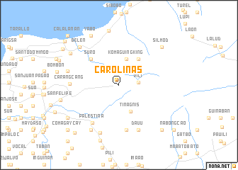
Carolinas (Naga, Philippines)Carolinas is a town in the Naga region of Philippines. An overview map of the region around Carolinas is displayed below.
regional and 3d topo map of Carolinas, Philippines ::
Carolinas airports ::
The nearest airport is KLO - Kalibo, located 240.8 km south west of Carolinas.
Nearby towns ::
Pili (3.0km east) //
Komaguingking (4.2km north) //
Binanwanaan (4.2km north) //
Tinagñis (4.6km south east) //
Caagol (5.0km north east) //
Suro (5.9km north west) //
Borabod (5.9km north west) //
Manguirin (5.9km north west) //
Curry (7.1km south) //
Palestina (7.3km south west) //
Baganito (7.6km south east) //
Dauu (7.6km south east) //
Carangcang (7.5km west) //
Cadlan (8.1km south) //
San Isidro (8.2km south west) //
San Jose Pagatpat (8.1km west) //
Belen (8.5km north west) //
Santo Niño (8.5km north west) //
Manguiring (8.6km north) //
Yabo (8.9km north west) //
Santa Rosa-Bonot (8.9km north west) //
Silmod (8.9km north east) //
Calabanga (8.9km north west) //
San Jose (9.3km south) //
Concepcion (9.4km south west) //
Gatbo (9.6km south east) //
San Antonio (10.2km south west) //
Comagaycay (10.5km south west) //
Capucnasan (10.5km south west) //
[all distances 'as the bird flies' and approximate]  Places with similar names to Carolinas, Philippines ::
// Karlins (DE)
// Carolinas (CU)
// Gura Luncii (RO)
// Corralinos (ES)
// Corralones (PE)
// Corralones (PE)
// Corralones (PE)
// Courlans (FR)
// Grlinci (SI)
Disclaimer :: Information on this page comes without warranty of any kind |
||
|
Where is Carolinas? Elevation and coordinates ::
Latitude (lat): 13°39'48"N Longitude (lon): 123°17'21"E
Elevation (approx.): 187m (map arrows pan, magnifying glasses zoom) |
||
|
Visiting Carolinas? Hotel/Accommodation ::
Book a hotel in Carolinas Travel Guide ::
Buy a travel guide for Philippines rental cars ::
car rental offers GPS waypoint ::
download a GPX waypoint (PoI) of Carolinas for your GPS receiver
|
||