|
search place name
|
||
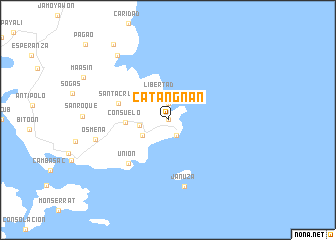
Catangnan (Surigao del Norte, Philippines)Catangnan is a town in the Surigao del Norte region of Philippines. An overview map of the region around Catangnan is displayed below.
regional and 3d topo map of Catangnan, Philippines ::
Catangnan airports ::
The nearest airport is TAC - Tacloban Daniel Z Romualdez, located 200.1 km north west of Catangnan.
Other airports nearby include CGY - Ladag Cagayan De Oro (228.2 km south west), Nearby towns ::
Catagnan (0.0km north) //
Cabitoonan (1.9km north) //
General Luna (2.0km south east) //
Libertad (2.9km north) //
Cabalawan (3.2km west) //
Malinao (3.3km south west) //
Consuelo (4.7km west) //
Santa Cruz (5.8km west) //
Union (6.5km south west) //
Januza (7.6km south) //
Osmena (8.2km west) //
Pilar (9.1km north west) //
Consolacion (10.4km north west) //
[all distances 'as the bird flies' and approximate] 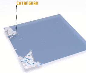 Places with similar names to Catangnan, Philippines ::
// Kedunganan (ID)
// Qitangnan (CN)
Disclaimer :: Information on this page comes without warranty of any kind |
||
|
Where is Catangnan? Elevation and coordinates ::
Latitude (lat): 9°48'0"N Longitude (lon): 126°9'0"E
Elevation (approx.): 4m (map arrows pan, magnifying glasses zoom) |
||
|
Visiting Catangnan? Hotel/Accommodation ::
Book a hotel in Catangnan Travel Guide ::
Buy a travel guide for Philippines rental cars ::
car rental offers GPS waypoint ::
download a GPX waypoint (PoI) of Catangnan for your GPS receiver
|
||