|
search place name
|
||
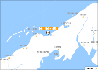
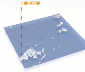
Cawa-Cawa (Tawi-Tawi, Philippines)Cawa-Cawa is a town in the Tawi-Tawi region of Philippines. An overview map of the region around Cawa-Cawa is displayed below.
regional and 3d topo map of Cawa-Cawa, Philippines ::
Cawa-Cawa airports ::
The nearest airport is LDU - Lahad Datu, located 189.3 km west of Cawa-Cawa.
Other airports nearby include TWU - Tawau (233.8 km south west), Nearby towns ::
 Places with similar names to Cawa-Cawa, Philippines ::
// Gawaygaway (PH)
// Gawaygaway (PH)
// KwaCawu (ZA)
// Kawakawa (NZ)
// Kawakwa (CD)
// Kawou Kowou (NE)
// Kwi Kwi (SD)
// Gwagwa (NG)
// Gwegwe (NG)
// Kwakwa (NG)
Disclaimer :: Information on this page comes without warranty of any kind |
||
|
Where is Cawa-Cawa? Elevation and coordinates ::
Latitude (lat): 5°13'59"N Longitude (lon): 120°1'10"E
Elevation (approx.): 26m (map arrows pan, magnifying glasses zoom) |
||
|
Visiting Cawa-Cawa? Hotel/Accommodation ::
Book a hotel in Cawa-Cawa Travel Guide ::
Buy a travel guide for Philippines rental cars ::
car rental offers GPS waypoint ::
download a GPX waypoint (PoI) of Cawa-Cawa for your GPS receiver
|
||