|
search place name
|
||
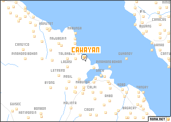
Cawayan (Masbate, Philippines)Cawayan is a town in the Masbate region of Philippines. An overview map of the region around Cawayan is displayed below.
regional and 3d topo map of Cawayan, Philippines ::
Cawayan airports ::
The nearest airport is KLO - Kalibo, located 153.7 km south west of Cawayan.
Other airports nearby include TAC - Tacloban Daniel Z Romualdez (203.4 km south east), BCD - Bacolod (206.7 km south), ILO - Iloilo (217.9 km south west), SJI - San Jose Antique (254.8 km south west), Nearby towns ::
Bilat (0.6km north west) //
Ulilang Cauayan (2.2km west) //
Nipa (2.2km west) //
Bolo (2.3km north west) //
Bantigue (2.4km south east) //
Talamban (3.9km west) //
Batuhan (4.2km south) //
Lagasi (4.1km west) //
Quinamaligan (4.4km south east) //
Anas (4.4km north west) //
Masbate (4.6km south east) //
Cagba (4.6km south east) //
Dacu (4.6km south east) //
Boyog (5.0km south) //
Bugsayon (5.3km north west) //
Cangbaliguia (5.3km south east) //
Pinamarobohan (5.3km east) //
Pasil (5.7km south west) //
Mabunga (5.8km south) //
Canmaya (6.1km south) //
Gañgao (6.2km north west) //
Lumbang (6.3km south) //
Mabunga (6.5km north) //
Letrero (6.5km south west) //
Tugbo (6.6km south east) //
Najubgan (6.9km north west) //
Calpi (7.0km south) //
Usab (7.2km south) //
Maputat (7.2km south) //
[all distances 'as the bird flies' and approximate]  Places with similar names to Cawayan, Philippines ::
Disclaimer :: Information on this page comes without warranty of any kind |
||
|
Where is Cawayan? Elevation and coordinates ::
Latitude (lat): 12°23'42"N Longitude (lon): 123°35'9"E
Elevation (approx.): 28m (map arrows pan, magnifying glasses zoom) |
||
|
Visiting Cawayan? Hotel/Accommodation ::
Book a hotel in Cawayan Travel Guide ::
Buy a travel guide for Philippines rental cars ::
car rental offers GPS waypoint ::
download a GPX waypoint (PoI) of Cawayan for your GPS receiver
|
||