|
search place name
|
||
Colongcolong (Aklan, Philippines)Colongcolong is a town in the Aklan region of Philippines. An overview map of the region around Colongcolong is displayed below.
regional and 3d topo map of Colongcolong, Philippines ::

Colongcolong airports ::
The nearest airport is KLO - Kalibo, located 26.1 km south east of Colongcolong.
Other airports nearby include SJI - San Jose Antique (119.0 km south), ILO - Iloilo (128.2 km south), BCD - Bacolod (153.3 km south east), NOP - Masbate Mactan Cebu Intl (257.8 km south east), Nearby towns ::
Yauan (1.4km west) //
Jawili (1.6km south) //
Naisud (1.6km south east) //
Ibajay (2.1km west) //
Agbago (3.2km west) //
Polo (3.2km west) //
Rizal (3.5km south) //
Bugtong Bato (3.4km east) //
Bagacay (3.6km south west) //
Tulang (4.0km south east) //
Regador (4.1km south east) //
Capilihan (4.2km south west) //
Santa Cruz (4.3km west) //
Boctonadoc (4.3km east) //
San Jose (4.5km south) //
Tagbaya (4.5km west) //
Maloco (4.7km south west) //
Naligusan (5.5km south) //
Naile (5.6km south) //
Cabugao (5.7km south east) //
Unat (5.9km south west) //
Ondoy (5.8km west) //
Agdugayan (6.2km south west) //
Arbili (6.8km south east) //
Mabusao (7.3km south) //
Antipolo (7.3km south west) //
Panayakan (7.5km south east) //
San Joaquin (8.0km south west) //
Aquino (8.1km west) //
[all distances 'as the bird flies' and approximate] 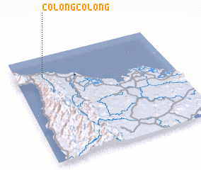 Places with similar names to Colongcolong, Philippines ::
// Colongcolong (PH)
// Culongculong (PH)
// Kalongkalong (PH)
// Kolong-Kolong (PH)
// Khlong Khlung (TH)
// Klangklang (MM)
Disclaimer :: Information on this page comes without warranty of any kind |
||
|
Where is Colongcolong? Elevation and coordinates ::
Latitude (lat): 11°48'51"N Longitude (lon): 122°10'46"E
Elevation (approx.): 10m (map arrows pan, magnifying glasses zoom) |
||
|
Visiting Colongcolong? Hotel/Accommodation ::
Book a hotel in Colongcolong Travel Guide ::
Buy a travel guide for Philippines rental cars ::
car rental offers GPS waypoint ::
download a GPX waypoint (PoI) of Colongcolong for your GPS receiver
|
||