|
search place name
|
||
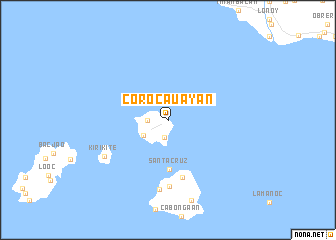
Corocauayan (Samar, Philippines)Corocauayan is a town in the Samar region of Philippines. An overview map of the region around Corocauayan is displayed below.
regional and 3d topo map of Corocauayan, Philippines ::
Corocauayan airports ::
The nearest airport is TAC - Tacloban Daniel Z Romualdez, located 105.8 km south east of Corocauayan.
Other airports nearby include NOP - Masbate Mactan Cebu Intl (191.8 km south), BCD - Bacolod (221.1 km south west), ILO - Iloilo (249.3 km south west), Nearby towns ::
Sevilla (1.9km south) //
Villhermosa (2.3km west) //
Balat-Guti (3.2km south west) //
Santa Cruz (5.5km south) //
Santo Niño (6.6km south) //
Ilihan (7.3km south) //
Baras (7.7km south) //
Kirikite (8.0km south west) //
[all distances 'as the bird flies' and approximate] 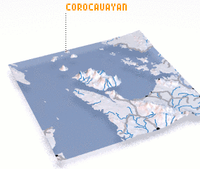 Places with similar names to Corocauayan, Philippines ::
// Caraycayon (PH)
// Corocauayan (PH)
// Karakoyun (TR)
// Kırkkoyun (TR)
// Kerekyan (RU)
// Gourkyana (BF)
// Qarah Qowyūn (IR)
// Gargoyan (PE)
// Garqu Yan (CN)
// Karakoyun (AM)
Disclaimer :: Information on this page comes without warranty of any kind |
||
|
Where is Corocauayan? Elevation and coordinates ::
Latitude (lat): 11°58'57"N Longitude (lon): 124°25'58"E
Elevation (approx.): -32768m (map arrows pan, magnifying glasses zoom) |
||
|
Visiting Corocauayan? Hotel/Accommodation ::
Book a hotel in Corocauayan Travel Guide ::
Buy a travel guide for Philippines rental cars ::
car rental offers GPS waypoint ::
download a GPX waypoint (PoI) of Corocauayan for your GPS receiver
|
||