|
search place name
|
||
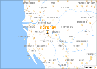
Dacanay (La Union, Philippines)Dacanay is a town in the La Union region of Philippines. An overview map of the region around Dacanay is displayed below.
regional and 3d topo map of Dacanay, Philippines ::
Dacanay airports ::
The nearest airport is BAG - Baguio, located 21.9 km east of Dacanay.
Other airports nearby include MNL - Manila Ninoy Aquino Intl (213.8 km south), Nearby towns ::
Ortega (0.0km north) //
Francia (0.0km north) //
Tavora (0.0km north) //
Betia (0.0km north) //
Gonzales (0.0km north) //
Tubao (0.1km south) //
San Pascual (1.2km south east) //
Garcia (1.8km west) //
Rizal (1.9km north) //
Halog (2.5km north east) //
Rizal (2.6km north east) //
Leones (2.6km north west) //
Barcelona (2.6km north west) //
Anduyan (2.8km east) //
Macalva (3.3km west) //
Santa Teresa (3.6km north) //
Verceles (3.7km south) //
Santa Cecilia (4.1km north west) //
Palina (4.0km south east) //
San Pedro (5.3km west) //
Santa Ana (5.3km west) //
San Vicente (5.6km west) //
Sobredillo (5.8km north) //
Bitag (5.8km north) //
Pidpid (5.8km north) //
San Agustin (5.6km west) //
San Antonio (5.6km west) //
Consolacion (5.6km west) //
Agoo (5.8km south west) //
[all distances 'as the bird flies' and approximate] 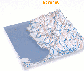 Places with similar names to Dacanay, Philippines ::
Disclaimer :: Information on this page comes without warranty of any kind |
||
|
Where is Dacanay? Elevation and coordinates ::
Latitude (lat): 16°21'0"N Longitude (lon): 120°25'0"E
Elevation (approx.): 27m (map arrows pan, magnifying glasses zoom) |
||
|
Visiting Dacanay? Hotel/Accommodation ::
Book a hotel in Dacanay Travel Guide ::
Buy a travel guide for Philippines rental cars ::
car rental offers GPS waypoint ::
download a GPX waypoint (PoI) of Dacanay for your GPS receiver
|
||