|
search place name
|
||
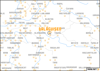
Dalaguisen (Abra, Philippines)Dalaguisen is a town in the Abra region of Philippines. An overview map of the region around Dalaguisen is displayed below.
regional and 3d topo map of Dalaguisen, Philippines ::
Dalaguisen airports ::
The nearest airport is BAG - Baguio, located 134.4 km south of Dalaguisen.
Nearby towns ::
Quimpal (0.0km north) //
Langbao (0.0km north) //
Tagodtod (1.4km north) //
Nagtupacan (1.4km south) //
La-Ang (1.9km north) //
Bangbangcag (2.6km south west) //
Paoa (2.6km north east) //
Tabiog (2.7km south) //
Tawing (2.7km east) //
Lagangilang (3.6km north) //
Alipasapas (3.5km west) //
Pagala (4.0km south west) //
Basbasa (4.0km north west) //
San Isidro (4.0km north east) //
San Miguel (4.1km south west) //
Pallao (4.1km north west) //
Bumagcat (5.1km north west) //
Alogtog (5.4km north) //
Malaki (5.6km north) //
Balais (5.6km north) //
Naguilian (5.8km south) //
Bucay (6.0km south west) //
Bugbug (6.5km south west) //
Lagben (6.6km north west) //
Calumbaya (6.6km north west) //
Bagalay (6.5km north west) //
Abang (7.6km south) //
Lublubba (7.6km north) //
Velasco (7.3km west) //
[all distances 'as the bird flies' and approximate]  Places with similar names to Dalaguisen, Philippines ::
// Dalagsa-an (PH)
// Delligsen (DE)
// Tillkausen (DE)
// Talczyn (PL)
// Tłuczań (PL)
// Dilagusun (ID)
// Dilagusun (ID)
// Tlacosanua (MX)
// Tilkoussine (MA)
// Tolgozino (RU)
Disclaimer :: Information on this page comes without warranty of any kind |
||
|
Where is Dalaguisen? Elevation and coordinates ::
Latitude (lat): 17°35'0"N Longitude (lon): 120°45'0"E
Elevation (approx.): 85m (map arrows pan, magnifying glasses zoom) |
||
|
Visiting Dalaguisen? Hotel/Accommodation ::
Book a hotel in Dalaguisen Travel Guide ::
Buy a travel guide for Philippines rental cars ::
car rental offers GPS waypoint ::
download a GPX waypoint (PoI) of Dalaguisen for your GPS receiver
|
||