|
search place name
|
||
Dale (Northern Samar, Philippines)Dale is a town in the Northern Samar region of Philippines. An overview map of the region around Dale is displayed below.
regional and 3d topo map of Dale, Philippines ::

Dale airports ::
The nearest airport is TAC - Tacloban Daniel Z Romualdez, located 146.6 km south of Dale.
Nearby towns ::
Cabarian (NaNkm north) //
Malobago (NaNkm north) //
Gosaran (NaNkm north) //
Giboluangan (NaNkm north) //
Pambuhan (1.6km north) //
Cababtoan (1.8km west) //
Camparanga (1.9km east) //
Canhumadal (3.7km south) //
Balud (4.3km south west) //
Burabud (5.2km east) //
Coroconog (5.3km south west) //
Manahao (5.4km south east) //
Paninirugnam (5.6km west) //
Lao-angon (6.6km west) //
Giparayan (6.9km south) //
Balnasan (7.2km south) //
San Roque (7.5km west) //
Bobolosan (7.5km east) //
Rauis (7.5km east) //
Laoang (7.5km east) //
Onay (8.1km north east) //
Catigbi-an (8.1km south east) //
Ginualgan (9.0km south) //
Yabyaban (9.1km south east) //
Langob (10.9km north east) //
[all distances 'as the bird flies' and approximate] 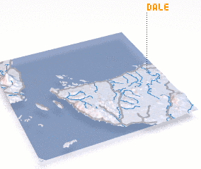 Places with similar names to Dale, Philippines ::
Disclaimer :: Information on this page comes without warranty of any kind |
||
|
Where is Dale? Elevation and coordinates ::
Latitude (lat): 12°33'0"N Longitude (lon): 124°56'0"E
Elevation (approx.): 6m (map arrows pan, magnifying glasses zoom) |
||
|
Visiting Dale? Hotel/Accommodation ::
Book a hotel in Dale Travel Guide ::
Buy a travel guide for Philippines rental cars ::
car rental offers GPS waypoint ::
download a GPX waypoint (PoI) of Dale for your GPS receiver
|
||