|
search place name
|
||
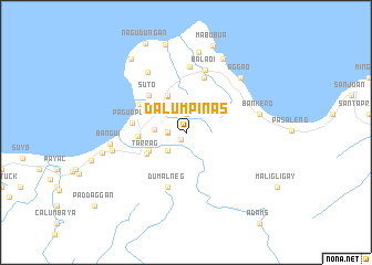
Dalumpinas (Ilocos Norte, Philippines)Dalumpinas is a town in the Ilocos Norte region of Philippines. An overview map of the region around Dalumpinas is displayed below.
regional and 3d topo map of Dalumpinas, Philippines ::
Nearby towns ::
Aggasi (0.9km south west) //
Assace (1.8km west) //
Cabacanan (1.9km north) //
Laguigu (1.9km north) //
Dampig (1.8km west) //
Maoin (2.6km south west) //
Baug (3.1km west) //
Baduang (3.4km north west) //
Bolalo (4.0km north west) //
Nagsabaran (4.1km north west) //
Lusong (4.1km north west) //
Subec (4.1km north west) //
Lanao (4.0km south west) //
Caramuangen (4.0km south west) //
Tarrag (4.3km south west) //
Tongotong (4.6km west) //
Suto (5.1km north west) //
Saud (5.1km north west) //
Burayoc (5.2km north west) //
Pagudpud (5.2km west) //
Dumalneg (5.8km south) //
Tabog (5.8km north) //
Balaoi (6.5km north) //
Caunayan (6.7km north) //
Caparispisan (7.1km north west) //
Nagbalagan (7.3km west) //
Bankero (7.3km east) //
Bangui (7.3km west) //
Aggao (7.7km north east) //
[all distances 'as the bird flies' and approximate]  Places with similar names to Dalumpinas, Philippines :: Disclaimer :: Information on this page comes without warranty of any kind |
||
|
Where is Dalumpinas? Elevation and coordinates ::
Latitude (lat): 18°33'0"N Longitude (lon): 120°50'0"E
Elevation (approx.): 179m (map arrows pan, magnifying glasses zoom) |
||
|
Visiting Dalumpinas? Hotel/Accommodation ::
Book a hotel in Dalumpinas Travel Guide ::
Buy a travel guide for Philippines rental cars ::
car rental offers GPS waypoint ::
download a GPX waypoint (PoI) of Dalumpinas for your GPS receiver
|
||