|
search place name
|
||
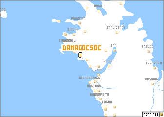
Damagocsoc (Camarines Sur, Philippines)Damagocsoc is a town in the Camarines Sur region of Philippines. An overview map of the region around Damagocsoc is displayed below.
regional and 3d topo map of Damagocsoc, Philippines ::
Nearby towns ::
Sulpa (1.2km east) //
Vito (2.5km north west) //
Calabanga (2.6km south east) //
Carinogan (4.0km south east) //
San Miguel (4.4km north west) //
Lamon (5.2km south east) //
Buenos Aires (5.8km south) //
Cauayan (5.7km east) //
Bahao (5.8km north) //
Bantigue (5.8km north) //
Siruma (5.8km north) //
Caglilag (6.0km south east) //
Boboan (6.2km north) //
Daligan (6.3km east) //
Halabang Baybay (6.6km north west) //
Bani (7.4km east) //
Magtang (8.0km south) //
Pamintan (8.1km north) //
Macahilo (8.2km south east) //
San Vicente (9.8km north east) //
Matandang Siruma (10.0km north west) //
[all distances 'as the bird flies' and approximate]  Places with similar names to Damagocsoc, Philippines :: Disclaimer :: Information on this page comes without warranty of any kind |
||
|
Where is Damagocsoc? Elevation and coordinates ::
Latitude (lat): 13°57'0"N Longitude (lon): 123°16'0"E
Elevation (approx.): 14m (map arrows pan, magnifying glasses zoom) |
||
|
Visiting Damagocsoc? Hotel/Accommodation ::
Book a hotel in Damagocsoc Travel Guide ::
Buy a travel guide for Philippines rental cars ::
car rental offers GPS waypoint ::
download a GPX waypoint (PoI) of Damagocsoc for your GPS receiver
|
||