|
search place name
|
||
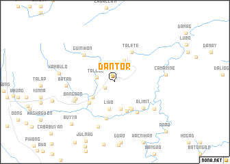
Dantor (Ifugao, Philippines)Dantor is a town in the Ifugao region of Philippines. An overview map of the region around Dantor is displayed below.
regional and 3d topo map of Dantor, Philippines ::
Dantor airports ::
The nearest airport is BAG - Baguio, located 88.6 km south west of Dantor.
Nearby towns ::
Tulaid (1.8km south west) //
Talboc (2.9km west) //
Langayan (3.2km north) //
Bongan (3.2km north) //
Mayoyao (3.8km north east) //
Aduyungan (4.3km south west) //
Inumbog (4.4km south) //
Liwo (4.5km south) //
Ayañgan (4.5km south) //
Angit (4.9km south east) //
Maupan (5.1km south east) //
Talallang (5.2km south) //
Ducligan (5.2km south west) //
Talete (5.6km north east) //
Hogngal (6.0km south east) //
Tanao (6.1km south) //
Alimit (6.2km south east) //
Guinihon (6.6km north west) //
Anaba (6.7km south west) //
Banga-an (7.1km south west) //
Buyabuyan (7.7km south) //
Matagguin (7.6km south east) //
Batad (7.7km west) //
Camarine (8.0km east) //
Buyya (9.7km south west) //
Anao (11.3km south east) //
[all distances 'as the bird flies' and approximate] 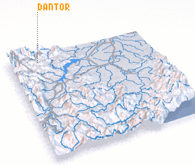 Places with similar names to Dantor, Philippines ::
Disclaimer :: Information on this page comes without warranty of any kind |
||
|
Where is Dantor? Elevation and coordinates ::
Latitude (lat): 16°56'21"N Longitude (lon): 121°12'31"E
Elevation (approx.): 1055m (map arrows pan, magnifying glasses zoom) |
||
|
Visiting Dantor? Hotel/Accommodation ::
Book a hotel in Dantor Travel Guide ::
Buy a travel guide for Philippines rental cars ::
car rental offers GPS waypoint ::
download a GPX waypoint (PoI) of Dantor for your GPS receiver
|
||