|
search place name
|
||
Dayuan (Sulu, Philippines)Dayuan is a town in the Sulu region of Philippines. An overview map of the region around Dayuan is displayed below.
regional and 3d topo map of Dayuan, Philippines ::

Dayuan airports ::
The nearest airport is ZAM - Zamboanga Intl, located 155.9 km north east of Dayuan.
Nearby towns ::
Baunu' Timbangan (0.6km north east) //
Payahan (1.4km north west) //
Adjid (1.8km south east) //
Tagbak (1.8km north) //
Licup (2.7km south west) //
Buanza (3.5km north west) //
Kajatian (3.6km north) //
Sawaki” (3.8km south) //
Batu Batu (3.8km south) //
Indanan (3.9km south west) //
Tando Patung (4.2km south east) //
Anuling (4.3km north) //
Matatal (4.3km south) //
Pantaw (4.3km east) //
Matanda (4.5km north west) //
Kabbon Maas (4.9km south west) //
Sindang (5.1km north west) //
Sionogan (5.1km west) //
Tandiunoy (5.2km north) //
Katian (5.4km south west) //
Pantao (5.4km east) //
Panabuan (5.4km south west) //
Nagay (5.4km west) //
Kunalum (5.5km south) //
Wanni Tunggat (5.6km south west) //
Tubig Samin (5.6km south) //
Mangalia (5.7km north west) //
Intramuros (5.7km north) //
San Raymundo (5.7km north) //
[all distances 'as the bird flies' and approximate] 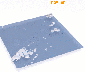 Places with similar names to Dayuan, Philippines ::
Disclaimer :: Information on this page comes without warranty of any kind |
||
|
Where is Dayuan? Elevation and coordinates ::
Latitude (lat): 5°59'56"N Longitude (lon): 120°59'41"E
Elevation (approx.): 140m (map arrows pan, magnifying glasses zoom) |
||
|
Visiting Dayuan? Hotel/Accommodation ::
Book a hotel in Dayuan Travel Guide ::
Buy a travel guide for Philippines rental cars ::
car rental offers GPS waypoint ::
download a GPX waypoint (PoI) of Dayuan for your GPS receiver
|
||