|
search place name
|
||
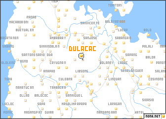
Dulacac (Pangasinan, Philippines)Dulacac is a town in the Pangasinan region of Philippines. An overview map of the region around Dulacac is displayed below.
regional and 3d topo map of Dulacac, Philippines ::
Dulacac airports ::
The nearest airport is BAG - Baguio, located 79.8 km east of Dulacac.
Other airports nearby include MNL - Manila Ninoy Aquino Intl (215.3 km south east), Nearby towns ::
Dolacac a Baleg (0.0km north) //
Litlit (1.8km west) //
dolacac a Melag (1.9km north) //
Libsong (3.7km south) //
Balayang (3.7km south) //
Bisocol (3.6km east) //
Amangbangan (3.7km north) //
Balayang (4.0km south east) //
Caranglaan (4.1km south west) //
Cabanaetan (4.0km south west) //
San Jose (4.1km north east) //
Banog (4.5km north) //
Magalong (4.8km south) //
Ranom Iloco (5.0km north west) //
Caranglaan (5.2km south) //
Patad-namani (5.1km south east) //
Amandiego (5.3km east) //
Garita (5.6km north) //
Cayugnan (5.7km west) //
Laplap (5.8km north) //
Calzada (5.8km south) //
Caabiangan (5.8km south) //
Bolaney (5.7km east) //
Banag Norte (5.8km north) //
Dolit (5.7km east) //
Tococ (5.7km east) //
Pogo (5.7km north east) //
Loboc (6.0km south) //
Inerangan (6.2km north) //
[all distances 'as the bird flies' and approximate]  Places with similar names to Dulacac, Philippines ::
Disclaimer :: Information on this page comes without warranty of any kind |
||
|
Where is Dulacac? Elevation and coordinates ::
Latitude (lat): 16°8'0"N Longitude (lon): 119°55'0"E
Elevation (approx.): 38m (map arrows pan, magnifying glasses zoom) |
||
|
Visiting Dulacac? Hotel/Accommodation ::
Book a hotel in Dulacac Travel Guide ::
Buy a travel guide for Philippines rental cars ::
car rental offers GPS waypoint ::
download a GPX waypoint (PoI) of Dulacac for your GPS receiver
|
||