|
search place name
|
||
Dullan (Misamis Occidental, Philippines)Dullan is a town in the Misamis Occidental region of Philippines. An overview map of the region around Dullan is displayed below.
regional and 3d topo map of Dullan, Philippines ::

Dullan airports ::
The nearest airport is LGP - Legazpi Pagadian, located 74.3 km south west of Dullan.
Other airports nearby include CGY - Ladag Cagayan De Oro (93.3 km east), DGT - Dumaguete (112.6 km north west), CEB - Cebu Cotabato (147.9 km south), NOP - Masbate Mactan Cebu Intl (209.4 km north), Nearby towns ::
Culpan (2.0km east) //
Caputal (2.4km south east) //
Bolibol (2.9km north) //
Victoria (4.5km north) //
Senote (4.5km north) //
Villaflor (4.9km north) //
Maular (5.1km east) //
Dagatan (5.4km north east) //
Dolipos (5.5km north) //
Pines (5.6km north east) //
Aloran (6.3km east) //
Balibol (6.6km north east) //
Pinis (7.5km north east) //
Buñga (7.5km north east) //
Talairon (7.7km north east) //
Labugon (7.7km east) //
Sabagusa (7.8km east) //
Mobod (7.9km north) //
Oroquieta (8.0km north east) //
Tuyabang (8.3km north) //
Binuangan (8.3km north) //
Macawa (8.7km south east) //
Tipan (8.9km north) //
Loboc (9.1km north east) //
Mojon (9.1km south east) //
Burgos (9.1km south east) //
Matugas (9.4km south east) //
Mapaan (10.1km south east) //
Panaon (11.0km south east) //
[all distances 'as the bird flies' and approximate] 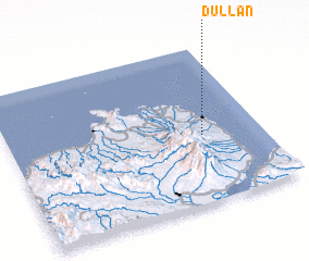 Places with similar names to Dullan, Philippines ::
Disclaimer :: Information on this page comes without warranty of any kind |
||
|
Where is Dullan? Elevation and coordinates ::
Latitude (lat): 8°25'35"N Longitude (lon): 123°45'50"E
Elevation (approx.): 191m (map arrows pan, magnifying glasses zoom) |
||
|
Visiting Dullan? Hotel/Accommodation ::
Book a hotel in Dullan Travel Guide ::
Buy a travel guide for Philippines rental cars ::
car rental offers GPS waypoint ::
download a GPX waypoint (PoI) of Dullan for your GPS receiver
|
||