|
search place name
|
||
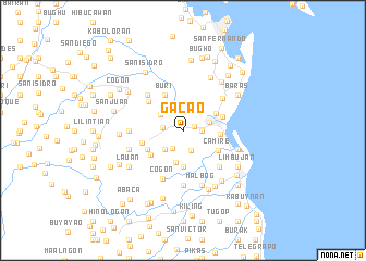
Gacao (Leyte, Philippines)Gacao is a town in the Leyte region of Philippines. An overview map of the region around Gacao is displayed below.
regional and 3d topo map of Gacao, Philippines ::
Gacao airports ::
The nearest airport is TAC - Tacloban Daniel Z Romualdez, located 10.9 km north east of Gacao.
Other airports nearby include NOP - Masbate Mactan Cebu Intl (142.6 km south west), DGT - Dumaguete (271.4 km south west), Nearby towns ::
Cacao (1.1km east) //
San Miguel (1.8km east) //
Hinapolon (1.8km east) //
San Juan (1.8km east) //
Cogon (1.8km east) //
Candahug (1.8km east) //
Cabarasan Dacu (1.8km east) //
Victoria (1.8km east) //
Cavita (2.0km south west) //
Anahaway (2.1km west) //
Balocawe (2.2km south) //
Malirong (2.3km north) //
Barayong (2.4km north east) //
Buri (2.6km north east) //
San Isidro (2.6km north east) //
Bolongto (2.6km south west) //
Palo (2.8km east) //
Tibac (2.9km north west) //
Anahauan (2.9km north west) //
Santa Cruz (3.4km south) //
San Antonio (3.7km south) //
Guindapulan (3.7km north east) //
San Joaquin (3.7km east) //
Camire (4.0km south east) //
San Agustin (4.1km south west) //
Buri (4.1km north west) //
Lanawan (4.1km south west) //
Luntad (4.2km east) //
Castilla (4.4km west) //
[all distances 'as the bird flies' and approximate] 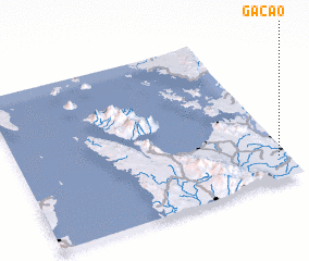 Places with similar names to Gacao, Philippines ::
Disclaimer :: Information on this page comes without warranty of any kind |
||
|
Where is Gacao? Elevation and coordinates ::
Latitude (lat): 11°9'0"N Longitude (lon): 124°58'0"E
Elevation (approx.): 12m (map arrows pan, magnifying glasses zoom) |
||
|
Visiting Gacao? Hotel/Accommodation ::
Book a hotel in Gacao Travel Guide ::
Buy a travel guide for Philippines rental cars ::
car rental offers GPS waypoint ::
download a GPX waypoint (PoI) of Gacao for your GPS receiver
|
||