|
search place name
|
||
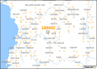
Gapang (Abra, Philippines)Gapang is a town in the Abra region of Philippines. An overview map of the region around Gapang is displayed below.
regional and 3d topo map of Gapang, Philippines ::
Gapang airports ::
The nearest airport is BAG - Baguio, located 112.5 km south of Gapang.
Nearby towns ::
Bato (2.3km east) //
South Balioag (2.5km north east) //
Nagcanasan (2.6km south) //
Maliplipit West (3.0km north) //
Babal-lasiuan (3.2km west) //
Dintan (3.4km south east) //
Maliplipit (3.7km north east) //
Tiquitic (3.7km north east) //
San Juan (3.9km east) //
Kinaviti (4.0km east) //
San Juan (4.0km east) //
Narnara (4.1km east) //
Ocup (4.5km south) //
Dalit (4.5km south) //
Bolbolo (4.4km south east) //
Pilar (4.5km north east) //
Gusing (4.6km west) //
Palicud (4.9km west) //
Balioag Norte (5.0km north east) //
Agagrao (4.9km west) //
Sucoc (5.0km west) //
Patad (5.3km north east) //
Pantoc (5.3km north east) //
San Pablo (5.7km north west) //
Vandrel (5.7km north west) //
Villavieja (6.0km south east) //
Bol-lilising (6.0km south east) //
Palo (6.0km south east) //
Manangduan (6.3km south) //
[all distances 'as the bird flies' and approximate] 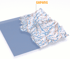 Places with similar names to Gapang, Philippines ::
Disclaimer :: Information on this page comes without warranty of any kind |
||
|
Where is Gapang? Elevation and coordinates ::
Latitude (lat): 17°23'24"N Longitude (lon): 120°33'45"E
Elevation (approx.): 367m (map arrows pan, magnifying glasses zoom) |
||
|
Visiting Gapang? Hotel/Accommodation ::
Book a hotel in Gapang Travel Guide ::
Buy a travel guide for Philippines rental cars ::
car rental offers GPS waypoint ::
download a GPX waypoint (PoI) of Gapang for your GPS receiver
|
||