|
search place name
|
||
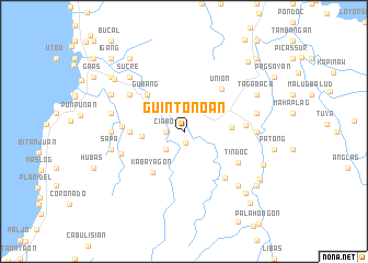
Guintonoan (Leyte, Philippines)Guintonoan is a town in the Leyte region of Philippines. An overview map of the region around Guintonoan is displayed below.
regional and 3d topo map of Guintonoan, Philippines ::
Guintonoan airports ::
The nearest airport is TAC - Tacloban Daniel Z Romualdez, located 69.0 km north of Guintonoan.
Other airports nearby include NOP - Masbate Mactan Cebu Intl (106.4 km west), BCD - Bacolod (215.6 km west), DGT - Dumaguete (225.6 km south west), Nearby towns ::
Tagatom (1.2km south) //
Ciabo (1.8km west) //
Pasanon (2.6km south west) //
Hunob (2.6km south west) //
Cambong (3.1km north west) //
Mapgap (4.2km west) //
Palahongon (4.8km east) //
Gubang (5.2km north west) //
Kabayagon (5.3km south west) //
San Juan (5.5km west) //
Union (5.7km north east) //
Bayugan (6.2km east) //
Maula (6.2km west) //
Tindoc (6.3km south east) //
Kinawit (6.3km south east) //
Butigan (6.6km north west) //
Buga (6.7km west) //
Pansagan (7.3km west) //
Bayugan (7.3km east) //
Kabalasan (7.5km west) //
Himamara (7.5km east) //
Sapa (7.5km west) //
Pamumudlon (7.8km south east) //
Sucre (7.8km north west) //
Tagabaca (8.2km north east) //
Buenavista (8.2km north west) //
Kinawit (8.2km north east) //
Mahaplag (8.7km south east) //
Libagong (8.7km north west) //
[all distances 'as the bird flies' and approximate] 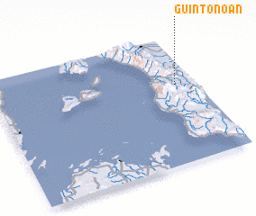 Places with similar names to Guintonoan, Philippines ::
Disclaimer :: Information on this page comes without warranty of any kind |
||
|
Where is Guintonoan? Elevation and coordinates ::
Latitude (lat): 10°37'0"N Longitude (lon): 124°54'0"E
Elevation (approx.): 127m (map arrows pan, magnifying glasses zoom) |
||
|
Visiting Guintonoan? Hotel/Accommodation ::
Book a hotel in Guintonoan Travel Guide ::
Buy a travel guide for Philippines rental cars ::
car rental offers GPS waypoint ::
download a GPX waypoint (PoI) of Guintonoan for your GPS receiver
|
||