|
search place name
|
||
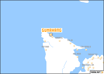
Gumahang (Masbate, Philippines)Gumahang is a town in the Masbate region of Philippines. An overview map of the region around Gumahang is displayed below.
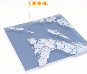
regional and 3d topo map of Gumahang, Philippines ::
Gumahang airports ::
The nearest airport is KLO - Kalibo, located 139.2 km south west of Gumahang.
Other airports nearby include BCD - Bacolod (217.8 km south), ILO - Iloilo (221.3 km south), TAC - Tacloban Daniel Z Romualdez (243.5 km south east), SJI - San Jose Antique (248.1 km south west), Nearby towns ::
 Places with similar names to Gumahang, Philippines ::
// Komohana Kai (US)
// Ka-Mhinga (ZA)
// Kamwhanga (TZ)
// Cẩm Hoàng (VN)
// Cẫm Hương (VN)
// Kami-hongō (JP)
// Hkam-hawng (MM)
Disclaimer :: Information on this page comes without warranty of any kind |
||
|
Where is Gumahang? Elevation and coordinates ::
Latitude (lat): 12°35'0"N Longitude (lon): 123°15'59"E
Elevation (approx.): 77m (map arrows pan, magnifying glasses zoom) |
||
|
Visiting Gumahang? Hotel/Accommodation ::
Book a hotel in Gumahang Travel Guide ::
Buy a travel guide for Philippines rental cars ::
car rental offers GPS waypoint ::
download a GPX waypoint (PoI) of Gumahang for your GPS receiver
|
||