|
search place name
|
||
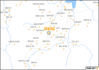
Ipang (Nueva Vizcaya, Philippines)Ipang is a town in the Nueva Vizcaya region of Philippines. An overview map of the region around Ipang is displayed below.
regional and 3d topo map of Ipang, Philippines ::
Ipang airports ::
The nearest airport is BAG - Baguio, located 62.9 km west of Ipang.
Nearby towns ::
Solano (0.9km south east) //
Polloc (1.5km east) //
Budad (1.5km east) //
Lattauan (2.4km north west) //
Asilap (3.0km north east) //
Mapaina (3.3km west) //
Bagabag (3.4km south) //
Tucal (3.5km north) //
Bonfal (3.5km south) //
Aggub (3.8km north east) //
Bascaran (4.2km east) //
Curipang (4.4km south east) //
Madiangat (4.6km south east) //
Lingay (4.7km south) //
Uddiawan (5.0km north west) //
Señora (5.3km south) //
Bintawan (5.3km north) //
Casat (5.2km south west) //
Rusu (5.4km east) //
Nalubbunan (5.6km south east) //
La Torre (5.7km south west) //
Villa Verde (6.0km north) //
Wacal (6.0km west) //
Bangan (6.1km east) //
Gannib (6.4km north) //
Bayombong (6.5km south west) //
Cutug (6.6km south west) //
Hablang (7.1km north west) //
Paitan (7.3km south) //
[all distances 'as the bird flies' and approximate] 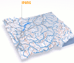 Places with similar names to Ipang, Philippines ::
Disclaimer :: Information on this page comes without warranty of any kind |
||
|
Where is Ipang? Elevation and coordinates ::
Latitude (lat): 16°31'51"N Longitude (lon): 121°11'11"E
Elevation (approx.): 251m (map arrows pan, magnifying glasses zoom) |
||
|
Visiting Ipang? Hotel/Accommodation ::
Book a hotel in Ipang Travel Guide ::
Buy a travel guide for Philippines rental cars ::
car rental offers GPS waypoint ::
download a GPX waypoint (PoI) of Ipang for your GPS receiver
|
||