|
search place name
|
||
Jaclupan (Cebu, Philippines)Jaclupan is a town in the Cebu region of Philippines. An overview map of the region around Jaclupan is displayed below.
regional and 3d topo map of Jaclupan, Philippines ::

Jaclupan airports ::
The nearest airport is NOP - Masbate Mactan Cebu Intl, located 17.8 km east of Jaclupan.
Other airports nearby include BCD - Bacolod (104.2 km west), DGT - Dumaguete (121.0 km south west), ILO - Iloilo (146.5 km west), TAC - Tacloban Daniel Z Romualdez (167.6 km north east), Nearby towns ::
Maghaway (0.4km south west) //
Candulawan (2.6km south east) //
Lagtang (2.7km south) //
Lawa-an (3.0km south west) //
Buhisan (3.4km north east) //
San Isidro (4.1km south east) //
Camp Four (4.1km north west) //
Tubod (4.1km south west) //
Kuanos (4.4km south west) //
Bulacao (4.5km south east) //
Pardo (4.5km south east) //
Vito (4.6km south west) //
Tabunok (4.6km south east) //
Punta Princesa (4.8km east) //
Mambaling (4.9km south east) //
Camiling (5.0km south east) //
Kaduawan (5.2km south west) //
Tisa (5.5km east) //
Linao (5.8km south) //
Mojon (5.9km south) //
Pamutan (5.8km east) //
Bulakaw (5.8km east) //
Inayawan (5.8km east) //
Bukawe (5.8km east) //
Quiot (5.8km east) //
Guindawajon (5.8km east) //
Basak (5.8km east) //
Buad (5.8km east) //
Guilaguila (5.8km east) //
[all distances 'as the bird flies' and approximate] 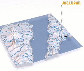
Disclaimer :: Information on this page comes without warranty of any kind |
||
|
Where is Jaclupan? Elevation and coordinates ::
Latitude (lat): 10°18'0"N Longitude (lon): 123°49'0"E
Elevation (approx.): 50m (map arrows pan, magnifying glasses zoom) |
||
|
Visiting Jaclupan? Hotel/Accommodation ::
Book a hotel in Jaclupan Travel Guide ::
Buy a travel guide for Philippines rental cars ::
car rental offers GPS waypoint ::
download a GPX waypoint (PoI) of Jaclupan for your GPS receiver
|
||