|
search place name
|
||
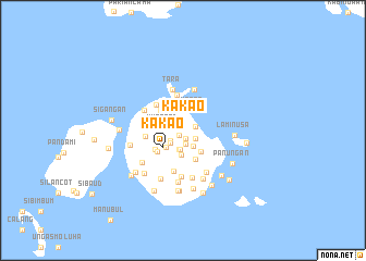
Kakao (Sulu, Philippines)Kakao is a town in the Sulu region of Philippines. An overview map of the region around Kakao is displayed below.
regional and 3d topo map of Kakao, Philippines ::
Kakao airports ::
The nearest airport is ZAM - Zamboanga Intl, located 200.6 km north east of Kakao.
Nearby towns ::
Pisak (0.6km south west) //
Tumpok (0.8km south) //
Latang (1.3km east) //
Kan Masillan (1.4km south) //
Buan (1.5km south east) //
Bunog (1.6km south west) //
Kan Ligas Kara (1.8km south west) //
Kungtad (1.9km west) //
Pigi Band (1.9km south east) //
Kan Munot (2.0km south) //
Tubig Buan (2.0km south) //
Manta (2.3km north east) //
Pialong (2.4km south west) //
Panggol (2.6km south) //
Kakao (2.6km south west) //
Sipanding (2.8km south east) //
Timballing (3.1km north west) //
Kabudu (3.2km south east) //
Talatak (3.4km south west) //
Kurol (3.5km south west) //
Tong Tara (3.7km north) //
Talisan (3.8km north west) //
Siondo (3.8km west) //
Tulling (3.9km west) //
Tubig Pansol (4.3km south) //
Tara (4.3km north) //
Luki Tara (4.4km north) //
Pagatpat (4.5km north west) //
Katubuh (4.8km south) //
[all distances 'as the bird flies' and approximate] 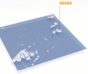 Places with similar names to Kakao, Philippines ::
Disclaimer :: Information on this page comes without warranty of any kind |
||
|
Where is Kakao? Elevation and coordinates ::
Latitude (lat): 5°33'29"N Longitude (lon): 120°51'53"E
Elevation (approx.): 57m (map arrows pan, magnifying glasses zoom) |
||
|
Visiting Kakao? Hotel/Accommodation ::
Book a hotel in Kakao Travel Guide ::
Buy a travel guide for Philippines rental cars ::
car rental offers GPS waypoint ::
download a GPX waypoint (PoI) of Kakao for your GPS receiver
|
||