|
search place name
|
||
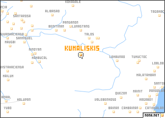
Kumaliskis (San Carlos, Philippines)Kumaliskis is a town in the San Carlos region of Philippines. An overview map of the region around Kumaliskis is displayed below.
regional and 3d topo map of Kumaliskis, Philippines ::
Kumaliskis airports ::
The nearest airport is BCD - Bacolod, located 33.5 km north west of Kumaliskis.
Other airports nearby include ILO - Iloilo (75.5 km west), NOP - Masbate Mactan Cebu Intl (87.8 km east), DGT - Dumaguete (130.3 km south), SJI - San Jose Antique (141.9 km west), Nearby towns ::
Sinongsongan (3.0km north east) //
Sibalo (4.4km north east) //
Talos (4.9km north) //
Cumalisquis (5.8km north east) //
Igmaya-an (6.0km north east) //
Lumagtang (6.6km north) //
Old Pandanon (7.7km north west) //
Pandanon (7.9km north) //
Lambunao (7.8km east) //
Benitinan (8.8km north west) //
Quezon (12.3km south east) //
[all distances 'as the bird flies' and approximate] 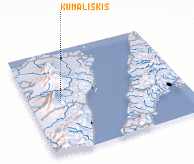 Places with similar names to Kumaliskis, Philippines ::
// Cumalisquis (PH)
Disclaimer :: Information on this page comes without warranty of any kind |
||
|
Where is Kumaliskis? Elevation and coordinates ::
Latitude (lat): 10°30'27"N Longitude (lon): 123°12'12"E
Elevation (approx.): 571m (map arrows pan, magnifying glasses zoom) |
||
|
Visiting Kumaliskis? Hotel/Accommodation ::
Book a hotel in Kumaliskis Travel Guide ::
Buy a travel guide for Philippines rental cars ::
car rental offers GPS waypoint ::
download a GPX waypoint (PoI) of Kumaliskis for your GPS receiver
|
||