|
search place name
|
||
Labinay (Ozamis, Philippines)Labinay is a town in the Ozamis region of Philippines. An overview map of the region around Labinay is displayed below.
regional and 3d topo map of Labinay, Philippines ::

Labinay airports ::
The nearest airport is LGP - Legazpi Pagadian, located 45.5 km south west of Labinay.
Other airports nearby include CGY - Ladag Cagayan De Oro (99.4 km east), CEB - Cebu Cotabato (114.3 km south east), DGT - Dumaguete (145.8 km north), ZAM - Zamboanga Intl (229.0 km south west), Nearby towns ::
Baga (1.0km west) //
Licohan (2.0km south east) //
Tadid (2.1km north east) //
Sinusa (2.8km south east) //
Polao (4.0km south west) //
Taguiquiron (4.1km south east) //
Migcanauay (4.1km south west) //
Dimaluno (4.1km north east) //
Villaba (4.2km west) //
Tangub (4.8km south) //
Kapalaran (4.8km west) //
Tubod (5.8km south east) //
Bagakay (6.0km north east) //
Lamalama (6.0km south east) //
Labuyo (6.2km south west) //
Kauswagan (6.6km west) //
Bongbong (6.7km north east) //
Dimalo-oc (6.7km south west) //
Calabayan (6.8km north east) //
Bulod (6.9km south east) //
Cogon (7.0km north) //
Misamis (7.6km east) //
Sagadan (7.6km south) //
Maquilao (7.6km south west) //
Garang (7.8km south west) //
Quinuman (7.8km north west) //
Baroy (7.9km south) //
Malaubang (8.0km north east) //
Manga (8.1km east) //
[all distances 'as the bird flies' and approximate] 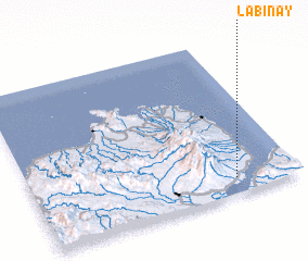 Places with similar names to Labinay, Philippines ::
Disclaimer :: Information on this page comes without warranty of any kind |
||
|
Where is Labinay? Elevation and coordinates ::
Latitude (lat): 8°6'0"N Longitude (lon): 123°46'0"E
Elevation (approx.): 66m (map arrows pan, magnifying glasses zoom) |
||
|
Visiting Labinay? Hotel/Accommodation ::
Book a hotel in Labinay Travel Guide ::
Buy a travel guide for Philippines rental cars ::
car rental offers GPS waypoint ::
download a GPX waypoint (PoI) of Labinay for your GPS receiver
|
||