|
search place name
|
||
Lactudan (Antique, Philippines)Lactudan is a town in the Antique region of Philippines. An overview map of the region around Lactudan is displayed below.
regional and 3d topo map of Lactudan, Philippines ::

Lactudan airports ::
The nearest airport is SJI - San Jose Antique, located 45.5 km south of Lactudan.
Other airports nearby include KLO - Kalibo (66.9 km north east), ILO - Iloilo (70.9 km south east), BCD - Bacolod (109.2 km south east), NOP - Masbate Mactan Cebu Intl (228.4 km south east), Nearby towns ::
Tigunhao (1.0km east) //
Magtaring (1.1km north) //
Intugasan (2.0km north west) //
Lupa-an (2.1km south) //
Panganapan (2.4km south east) //
Jaguikican (2.7km west) //
Igtadiao (2.7km west) //
Igbobong Viejo (2.7km west) //
Leon (2.7km west) //
Cadajug (2.7km west) //
Canituan (2.7km west) //
Lugta (2.7km west) //
Pascuala (2.7km west) //
Manguibo (2.7km west) //
Casit-an (2.7km west) //
Guiamon (2.7km west) //
Igbobong (3.1km north west) //
Tigaaran (3.5km north) //
Menganilla (3.5km north) //
Latason (3.5km north) //
Baclayan (3.5km north) //
Laua-an (3.8km west) //
Liberato (4.0km south) //
Intao (3.9km west) //
Cabariwan (4.1km south west) //
Binangbang (4.3km north west) //
Narirong (4.3km north west) //
Mauno (4.4km north west) //
Lawa-an (4.5km west) //
[all distances 'as the bird flies' and approximate] 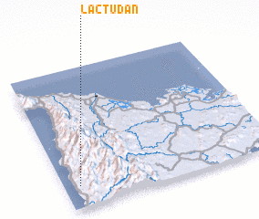 Places with similar names to Lactudan, Philippines ::
// Luuk Datan (PH)
Disclaimer :: Information on this page comes without warranty of any kind |
||
|
Where is Lactudan? Elevation and coordinates ::
Latitude (lat): 11°9'12"N Longitude (lon): 122°4'28"E
Elevation (approx.): 165m (map arrows pan, magnifying glasses zoom) |
||
|
Visiting Lactudan? Hotel/Accommodation ::
Book a hotel in Lactudan Travel Guide ::
Buy a travel guide for Philippines rental cars ::
car rental offers GPS waypoint ::
download a GPX waypoint (PoI) of Lactudan for your GPS receiver
|
||