|
search place name
|
||
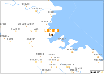
Lapinig (Northern Samar, Philippines)Lapinig is a town in the Northern Samar region of Philippines. An overview map of the region around Lapinig is displayed below.
regional and 3d topo map of Lapinig, Philippines ::
Lapinig airports ::
The nearest airport is TAC - Tacloban Daniel Z Romualdez, located 123.9 km south of Lapinig.
Nearby towns ::
May-igot (3.8km south east) //
Cagamutan (5.1km north) //
Lo-oc (6.0km west) //
Buang (7.2km south) //
Rizal (7.6km north) //
Cahugwayan (7.6km north) //
Mabini (7.6km north) //
Jipapad (7.6km south west) //
Jeuaran (7.6km west) //
Can Maria (7.7km west) //
Gamay (8.1km north) //
Tuog (8.0km west) //
Tinagan (8.3km south west) //
Tagpili (8.5km south) //
San Ramon (8.9km south east) //
Arteche (9.2km south east) //
[all distances 'as the bird flies' and approximate]  Places with similar names to Lapinig, Philippines ::
Disclaimer :: Information on this page comes without warranty of any kind |
||
|
Where is Lapinig? Elevation and coordinates ::
Latitude (lat): 12°18'54"N Longitude (lon): 125°18'6"E
Elevation (approx.): 5m (map arrows pan, magnifying glasses zoom) |
||
|
Visiting Lapinig? Hotel/Accommodation ::
Book a hotel in Lapinig Travel Guide ::
Buy a travel guide for Philippines rental cars ::
car rental offers GPS waypoint ::
download a GPX waypoint (PoI) of Lapinig for your GPS receiver
|
||