|
search place name
|
||
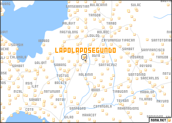
Lapolapo Segundo (Batangas, Philippines)Lapolapo Segundo is a town in the Batangas region of Philippines. An overview map of the region around Lapolapo Segundo is displayed below.
regional and 3d topo map of Lapolapo Segundo, Philippines ::
Lapolapo Segundo airports ::
The nearest airport is MNL - Manila Ninoy Aquino Intl, located 70.0 km north of Lapolapo Segundo.
Nearby towns ::
Lapolapo Primero (0.0km north) //
San Jose (1.4km south west) //
Aya (1.9km north) //
Natunuan (1.8km west) //
Salaban (1.8km west) //
Adya (2.1km east) //
Dagatan (2.5km south west) //
Pinagtongolan (2.6km north west) //
Buñgahan (2.6km west) //
Galamayamo (3.3km north west) //
Balagtasin (3.5km north west) //
Malainin (3.7km south) //
Maslit (3.6km east) //
Masiit (3.6km east) //
Palanca (3.6km west) //
Bigain Primero (3.6km west) //
Mabini (3.8km east) //
Pangao (3.9km north) //
Santo Niño (4.0km south east) //
Mojon (4.1km north) //
Lumil (4.0km south west) //
Pinagtongolan (4.1km north west) //
Calamias (4.4km south east) //
Rizal (4.5km east) //
Lalayat (4.6km south west) //
Salaban (4.9km south) //
Santa Cruz (4.8km east) //
Lodlod (5.0km north) //
Taysan (5.0km south west) //
[all distances 'as the bird flies' and approximate] 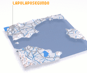 Places with similar names to Lapolapo Segundo, Philippines :: Disclaimer :: Information on this page comes without warranty of any kind |
||
|
Where is Lapolapo Segundo? Elevation and coordinates ::
Latitude (lat): 13°53'0"N Longitude (lon): 121°7'0"E
Elevation (approx.): 245m (map arrows pan, magnifying glasses zoom) |
||
|
Visiting Lapolapo Segundo? Hotel/Accommodation ::
Book a hotel in Lapolapo Segundo Travel Guide ::
Buy a travel guide for Philippines rental cars ::
car rental offers GPS waypoint ::
download a GPX waypoint (PoI) of Lapolapo Segundo for your GPS receiver
|
||