|
search place name
|
||
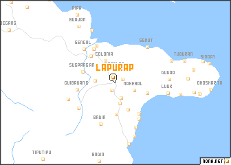
Lapurap (Basilan, Philippines)Lapurap is a town in the Basilan region of Philippines. An overview map of the region around Lapurap is displayed below.
regional and 3d topo map of Lapurap, Philippines ::
Lapurap airports ::
The nearest airport is ZAM - Zamboanga Intl, located 36.5 km north of Lapurap.
Other airports nearby include LGP - Legazpi Pagadian (195.5 km north east), Nearby towns ::
Mohebal (1.3km north east) //
Sama (1.5km south west) //
Tablas (1.9km north) //
Sabong (2.7km south) //
Balobo (3.3km west) //
Mahebal (3.3km south east) //
Monebal (3.4km north west) //
Tipo-Tipo (3.5km south) //
Colonia (3.9km north west) //
Yacan (4.9km south east) //
Parangbasak (5.2km south) //
Lahilahi (5.5km east) //
Sugpangan (5.6km west) //
Guibauan (5.8km north west) //
Guibauang (6.2km west) //
Tambunan (6.3km south east) //
Lamitan (6.5km north west) //
Bato (6.7km north west) //
Lipid (7.1km south east) //
Badia (7.1km south) //
Bulingan (7.2km south west) //
Sengal (7.4km north west) //
Semut (7.7km north east) //
Dangkalan (8.0km south east) //
Buhesapa (8.1km west) //
Luuk (8.6km east) //
Dugaa (8.7km east) //
Balas (9.2km north west) //
Mabi (9.3km south) //
[all distances 'as the bird flies' and approximate] 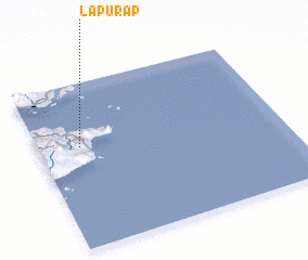 Places with similar names to Lapurap, Philippines :: Disclaimer :: Information on this page comes without warranty of any kind |
||
|
Where is Lapurap? Elevation and coordinates ::
Latitude (lat): 6°36'43"N Longitude (lon): 122°10'21"E
Elevation (approx.): 87m (map arrows pan, magnifying glasses zoom) |
||
|
Visiting Lapurap? Hotel/Accommodation ::
Book a hotel in Lapurap Travel Guide ::
Buy a travel guide for Philippines rental cars ::
car rental offers GPS waypoint ::
download a GPX waypoint (PoI) of Lapurap for your GPS receiver
|
||