|
search place name
|
||
Libertad (Cebu, Philippines)Libertad is a town in the Cebu region of Philippines. An overview map of the region around Libertad is displayed below.
regional and 3d topo map of Libertad, Philippines ::

Libertad airports ::
The nearest airport is NOP - Masbate Mactan Cebu Intl, located 99.1 km south of Libertad.
Other airports nearby include TAC - Tacloban Daniel Z Romualdez (110.4 km east), BCD - Bacolod (134.1 km south west), ILO - Iloilo (169.8 km west), KLO - Kalibo (186.7 km west), Nearby towns ::
Tinubdan (2.1km south west) //
Bagay (2.2km east) //
Dalingding (2.5km north west) //
Somimbang (2.8km north west) //
Pajo (3.1km north) //
Badiang (3.7km south west) //
Calape (3.8km south east) //
Bitoon (4.0km north west) //
Tominhao (4.1km north east) //
Libug (4.1km north) //
Paypay (4.6km west) //
Malbago (4.8km south) //
Dapdap (5.4km north east) //
Malbago (5.6km north) //
Carnaza (5.6km north) //
Daanbantayan (5.8km north) //
Bakhawan (5.8km west) //
Panugnawan (5.9km south west) //
Lanao (6.8km north) //
Talisay (6.9km north east) //
Bateria (7.1km south) //
Buenavista (7.1km south west) //
Agojo (7.3km north) //
Curva (7.7km south) //
Campatoc (7.7km north east) //
Dalingding (7.7km south west) //
Kawit (7.7km west) //
Bangun (8.0km south west) //
Tapilon (8.5km north) //
[all distances 'as the bird flies' and approximate] 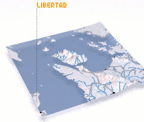 Places with similar names to Libertad, Philippines ::
Disclaimer :: Information on this page comes without warranty of any kind |
||
|
Where is Libertad? Elevation and coordinates ::
Latitude (lat): 11°12'9"N Longitude (lon): 124°1'2"E
Elevation (approx.): 29m (map arrows pan, magnifying glasses zoom) |
||
|
Visiting Libertad? Hotel/Accommodation ::
Book a hotel in Libertad Travel Guide ::
Buy a travel guide for Philippines rental cars ::
car rental offers GPS waypoint ::
download a GPX waypoint (PoI) of Libertad for your GPS receiver
|
||