|
search place name
|
||
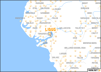
Lidug (Ilocos Sur, Philippines)Lidug is a town in the Ilocos Sur region of Philippines. An overview map of the region around Lidug is displayed below.
regional and 3d topo map of Lidug, Philippines ::
Lidug airports ::
The nearest airport is BAG - Baguio, located 129.7 km south of Lidug.
Nearby towns ::
Barabong (0.0km north) //
Basug (1.7km south east) //
Baetan (1.9km south) //
Taramuting (1.8km east) //
Sacuyya (2.0km east) //
Rizal (2.4km north east) //
Subec (2.6km south west) //
Nagtapacan (2.6km south west) //
Patucannay (2.6km south west) //
Manueva (2.6km south east) //
Santa Antigua (2.6km north west) //
Tamurong (2.6km west) //
Mabilbila Norte (2.9km south east) //
Banaoang (3.4km north east) //
Dammay (3.5km west) //
Labut Sur (3.7km south) //
Mabilbila Sur (3.7km south) //
Caniogan (3.7km south) //
Raois (3.7km north) //
Rancho (4.0km south west) //
Cerna (4.0km south west) //
Oribi (4.1km south west) //
Casiber (4.1km south west) //
Capariaan (4.0km north west) //
Naguilian (4.0km north west) //
Nansuagao (4.0km north west) //
Rugsuanan (4.1km north west) //
Santa (4.8km south) //
Caoayan (5.0km north west) //
[all distances 'as the bird flies' and approximate] 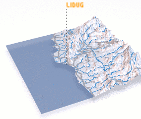 Places with similar names to Lidug, Philippines ::
Disclaimer :: Information on this page comes without warranty of any kind |
||
|
Where is Lidug? Elevation and coordinates ::
Latitude (lat): 17°32'0"N Longitude (lon): 120°26'0"E
Elevation (approx.): 6m (map arrows pan, magnifying glasses zoom) |
||
|
Visiting Lidug? Hotel/Accommodation ::
Book a hotel in Lidug Travel Guide ::
Buy a travel guide for Philippines rental cars ::
car rental offers GPS waypoint ::
download a GPX waypoint (PoI) of Lidug for your GPS receiver
|
||