|
search place name
|
||
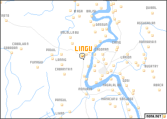
Lingu (Cagayan, Philippines)Lingu is a town in the Cagayan region of Philippines. An overview map of the region around Lingu is displayed below.
regional and 3d topo map of Lingu, Philippines ::
Lingu airports ::
The nearest airport is BAG - Baguio, located 179.6 km south west of Lingu.
Nearby towns ::
Fugu (1.3km north east) //
Atulayan (1.3km north east) //
Naguilian (1.3km north east) //
Maguirig (1.3km north east) //
Pallua (1.8km south east) //
Solano (2.2km north east) //
Talogtog (2.6km north east) //
Bagay (2.8km south east) //
Calamagui (3.2km east) //
Buntun (3.5km south east) //
Maddarulug (3.7km south) //
Basi (4.0km north east) //
Cabaruan (4.3km north west) //
Maddarulug (4.4km south) //
Cagoran (4.3km east) //
Annafunan (4.4km east) //
Lannig (4.7km west) //
Atayao (4.9km west) //
Atulayan (5.0km east) //
Cabaritan (5.3km south west) //
Ugac (5.3km south east) //
Natappian (5.4km north east) //
Malallabu (5.7km north west) //
Cataggaman Nuevo (5.7km south east) //
Cataggaman Viejo (5.9km south east) //
Tuguegarao City (6.0km south east) //
Ruyu (6.4km south east) //
Lanna (6.7km north) //
Caggay (6.6km east) //
[all distances 'as the bird flies' and approximate] 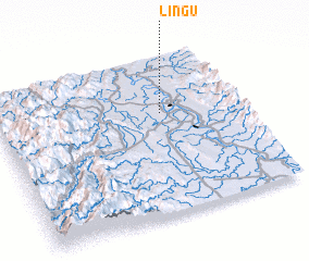 Places with similar names to Lingu, Philippines ::
Disclaimer :: Information on this page comes without warranty of any kind |
||
|
Where is Lingu? Elevation and coordinates ::
Latitude (lat): 17°38'22"N Longitude (lon): 121°40'40"E
Elevation (approx.): 35m (map arrows pan, magnifying glasses zoom) |
||
|
Visiting Lingu? Hotel/Accommodation ::
Book a hotel in Lingu Travel Guide ::
Buy a travel guide for Philippines rental cars ::
car rental offers GPS waypoint ::
download a GPX waypoint (PoI) of Lingu for your GPS receiver
|
||