|
search place name
|
||
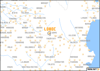
Loboc (Albay, Philippines)Loboc is a town in the Albay region of Philippines. An overview map of the region around Loboc is displayed below.
regional and 3d topo map of Loboc, Philippines ::
Loboc airports ::
The nearest airport is KLO - Kalibo, located 215.3 km south west of Loboc.
Other airports nearby include TAC - Tacloban Daniel Z Romualdez (264.3 km south east), Nearby towns ::
Tinampo (1.9km north) //
Quintinday (1.8km east) //
Bogñabong (1.8km east) //
Quiragñay (1.8km east) //
Libod (1.8km east) //
Tinago (1.8km east) //
Maninila (1.8km east) //
Bantonan (1.8km east) //
Del Rosario (1.8km east) //
Calabidogñan (1.8km east) //
Gapo (1.8km east) //
Gotob (1.8km east) //
Tumpa (2.0km north) //
Camalig (2.1km east) //
Bariw (2.2km south) //
Tagaytay (2.4km south) //
Maninila (3.0km north) //
Baligang (3.7km south) //
Salugan (3.6km east) //
Sua (3.6km east) //
Guinobatan (3.8km west) //
Palanog (4.1km south west) //
Camalia (4.1km south west) //
Kitago (4.1km south west) //
Banao (4.1km north west) //
Mina (4.1km south east) //
Cituinan (4.1km south east) //
Cabagñan (4.3km east) //
Masarauag (4.7km north) //
[all distances 'as the bird flies' and approximate] 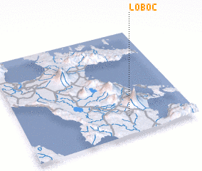 Places with similar names to Loboc, Philippines ::
Disclaimer :: Information on this page comes without warranty of any kind |
||
|
Where is Loboc? Elevation and coordinates ::
Latitude (lat): 13°11'0"N Longitude (lon): 123°38'0"E
Elevation (approx.): 115m (map arrows pan, magnifying glasses zoom) |
||
|
Visiting Loboc? Hotel/Accommodation ::
Book a hotel in Loboc Travel Guide ::
Buy a travel guide for Philippines rental cars ::
car rental offers GPS waypoint ::
download a GPX waypoint (PoI) of Loboc for your GPS receiver
|
||