|
search place name
|
||
Lomboy (Capiz, Philippines)Lomboy is a town in the Capiz region of Philippines. An overview map of the region around Lomboy is displayed below.
regional and 3d topo map of Lomboy, Philippines ::

Lomboy airports ::
The nearest airport is KLO - Kalibo, located 48.8 km west of Lomboy.
Other airports nearby include ILO - Iloilo (97.6 km south), BCD - Bacolod (102.0 km south), SJI - San Jose Antique (129.4 km south west), NOP - Masbate Mactan Cebu Intl (188.5 km south east), Nearby towns ::
Talasa (0.6km south) //
Bato (0.7km south) //
Tico (0.9km south west) //
Ilamnay (0.9km south) //
Bahit (1.3km south west) //
Linatiran (1.3km north) //
Panay (1.3km west) //
Bantigue (1.3km south west) //
Bagacay (1.5km south east) //
Magobilan (1.5km south west) //
Calitan (1.7km south west) //
Unhawon (1.7km south) //
Buñga (1.9km north east) //
Tanza Sur (2.4km west) //
Anhawon (2.7km south west) //
Bato (2.8km west) //
Tanza Norte (2.9km north) //
Cabugao Este (3.3km south) //
Calapaoan (3.3km south) //
Lanipga (3.3km south east) //
Malibili (3.3km west) //
Cabugao (3.5km south) //
Agbanban (3.6km west) //
Bago-Chiquito (3.8km south west) //
Tanza (3.8km north west) //
Candual (4.2km south west) //
Pawa (4.8km east) //
Pawa (4.9km north east) //
Cogon (5.1km south) //
[all distances 'as the bird flies' and approximate] 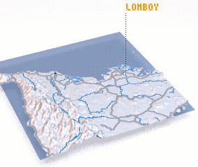 Places with similar names to Lomboy, Philippines ::
Disclaimer :: Information on this page comes without warranty of any kind |
||
|
Where is Lomboy? Elevation and coordinates ::
Latitude (lat): 11°33'24"N Longitude (lon): 122°48'22"E
Elevation (approx.): 1m (map arrows pan, magnifying glasses zoom) |
||
|
Visiting Lomboy? Hotel/Accommodation ::
Book a hotel in Lomboy Travel Guide ::
Buy a travel guide for Philippines rental cars ::
car rental offers GPS waypoint ::
download a GPX waypoint (PoI) of Lomboy for your GPS receiver
|
||