|
search place name
|
||
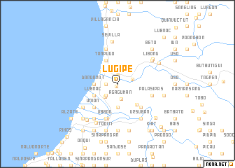
Lugipe (Ilocos Sur, Philippines)Lugipe is a town in the Ilocos Sur region of Philippines. An overview map of the region around Lugipe is displayed below.
regional and 3d topo map of Lugipe, Philippines ::
Lugipe airports ::
The nearest airport is BAG - Baguio, located 65.7 km south of Lugipe.
Nearby towns ::
Gwan (0.5km south) //
Baringcucurong (1.3km north) //
Bitalag (1.9km north) //
Santa Maria (1.8km west) //
Ag-aguman (2.5km south) //
Cabugao (2.4km east) //
San Miguel (2.6km south west) //
Tarangotong (2.6km south west) //
Pal-logan (2.6km south west) //
Tallawen (2.6km south west) //
Cabugbugan (2.6km south west) //
Tagudin (2.8km south west) //
Libtong (3.1km north west) //
Viejo (3.7km south) //
Ilocano (3.7km south) //
San Rafael (3.7km south) //
Maliclico (3.7km south) //
Cabulanglangan (3.7km south) //
Vigviga (3.7km south) //
Dardarat (3.5km west) //
Bimmanga (3.5km west) //
Becques (4.1km north west) //
Tampugo (4.1km north west) //
Bucao (4.0km south west) //
Borono (4.0km south west) //
Lubnac (4.0km south west) //
Bio (4.0km south west) //
Ambalayat (4.4km south east) //
Bannaa (5.1km south east) //
[all distances 'as the bird flies' and approximate] 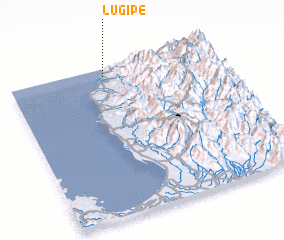 Places with similar names to Lugipe, Philippines ::
Disclaimer :: Information on this page comes without warranty of any kind |
||
|
Where is Lugipe? Elevation and coordinates ::
Latitude (lat): 16°57'0"N Longitude (lon): 120°28'0"E
Elevation (approx.): 34m (map arrows pan, magnifying glasses zoom) |
||
|
Visiting Lugipe? Hotel/Accommodation ::
Book a hotel in Lugipe Travel Guide ::
Buy a travel guide for Philippines rental cars ::
car rental offers GPS waypoint ::
download a GPX waypoint (PoI) of Lugipe for your GPS receiver
|
||