|
search place name
|
||
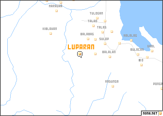
Luparan (Davao del Sur, Philippines)Luparan is a town in the Davao del Sur region of Philippines. An overview map of the region around Luparan is displayed below.
regional and 3d topo map of Luparan, Philippines ::
Luparan airports ::
The nearest airport is CEB - Cebu Cotabato, located 137.7 km north west of Luparan.
Other airports nearby include CGY - Ladag Cagayan De Oro (218.5 km north), LGP - Legazpi Pagadian (246.8 km north west), Nearby towns ::
Waterfall (3.3km east) //
Balabag (4.6km north) //
Kiblawan (5.3km north east) //
Sulop (6.3km north east) //
Balalan (6.5km east) //
Talas (7.7km north east) //
Talao (8.0km north) //
Kiblawan (9.0km north west) //
Palili (9.2km north east) //
Bolton (9.4km east) //
Madunga (9.7km south east) //
Padada (10.2km north east) //
[all distances 'as the bird flies' and approximate] 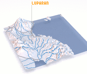 Places with similar names to Luparan, Philippines ::
// Lapirian (PH)
// Laparan (PH)
// Laperian (PH)
// Lipayran (PH)
// La Porrona (CO)
// La Purnia (CO)
// La Porreña (MX)
// La Parreña (VE)
// La Perena (VE)
// La Pereña (VE)
Disclaimer :: Information on this page comes without warranty of any kind |
||
|
Where is Luparan? Elevation and coordinates ::
Latitude (lat): 6°33'49"N Longitude (lon): 125°18'0"E
Elevation (approx.): 155m (map arrows pan, magnifying glasses zoom) |
||
|
Visiting Luparan? Hotel/Accommodation ::
Book a hotel in Luparan Travel Guide ::
Buy a travel guide for Philippines rental cars ::
car rental offers GPS waypoint ::
download a GPX waypoint (PoI) of Luparan for your GPS receiver
|
||