|
search place name
|
||
Lutiman (Zamboanga del Sur, Philippines)Lutiman is a town in the Zamboanga del Sur region of Philippines. An overview map of the region around Lutiman is displayed below.
regional and 3d topo map of Lutiman, Philippines ::

Lutiman airports ::
The nearest airport is LGP - Legazpi Pagadian, located 67.2 km north east of Lutiman.
Other airports nearby include ZAM - Zamboanga Intl (117.6 km south west), CEB - Cebu Cotabato (150.3 km east), DGT - Dumaguete (200.4 km north), CGY - Ladag Cagayan De Oro (210.0 km north east), Nearby towns ::
Lambayogan (0.5km south east) //
Concepcion (0.8km north east) //
Lunapa (1.8km south east) //
Tangcong (1.9km south east) //
Bucacao (2.0km north east) //
Gapol (2.5km south west) //
Taguisian (2.8km west) //
Bulacan (2.8km north west) //
Timbang-Timbang (2.8km south east) //
Sisip (3.6km south) //
Balungisan (3.8km north west) //
San Isidro (3.9km north west) //
Tangalan (4.0km south west) //
Takupong (4.0km south west) //
Lutiman (4.2km south east) //
Sumulong (4.3km west) //
Baoaran (4.4km south west) //
Gulayan (4.7km south west) //
Dumpok (4.9km north east) //
Kawayan (4.9km south west) //
Guintocan (5.5km north) //
Carilao (5.8km west) //
Bomba (6.0km south east) //
Alicia (6.1km south east) //
Dapitan (6.1km north west) //
Balutan (6.2km north east) //
Kauswagan (6.5km east) //
Buayan (6.6km south west) //
Payongan (6.8km south east) //
[all distances 'as the bird flies' and approximate] 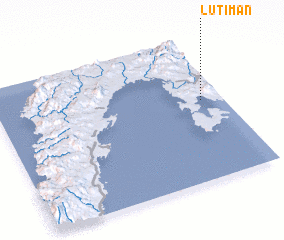 Places with similar names to Lutiman, Philippines ::
Disclaimer :: Information on this page comes without warranty of any kind |
||
|
Where is Lutiman? Elevation and coordinates ::
Latitude (lat): 7°33'52"N Longitude (lon): 122°54'31"E
Elevation (approx.): 5m (map arrows pan, magnifying glasses zoom) |
||
|
Visiting Lutiman? Hotel/Accommodation ::
Book a hotel in Lutiman Travel Guide ::
Buy a travel guide for Philippines rental cars ::
car rental offers GPS waypoint ::
download a GPX waypoint (PoI) of Lutiman for your GPS receiver
|
||