|
search place name
|
||
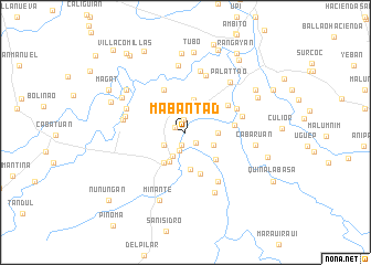
Mabantad (Isabela, Philippines)Mabantad is a town in the Isabela region of Philippines. An overview map of the region around Mabantad is displayed below.
regional and 3d topo map of Mabantad, Philippines ::
Mabantad airports ::
The nearest airport is BAG - Baguio, located 140.4 km south west of Mabantad.
Nearby towns ::
Tagaran (1.1km north west) //
Nappaccu Pequeño (1.3km north) //
Marung (1.3km south) //
Carabatan (1.5km south east) //
Turayung (1.9km south) //
Caonayan (2.5km south west) //
Palasie (2.7km south west) //
Andarayan (3.0km south east) //
Nacampegan (3.1km east) //
Labinab (3.3km north east) //
Nappaccu Grande (3.3km north) //
Cauayan (3.3km south west) //
Labinab (3.8km south) //
Marabulig (3.8km south west) //
Dabburab Punta (3.8km south west) //
Magdalena (3.8km south west) //
Caggong (3.8km south west) //
Carabbatan Punta (3.8km south west) //
Carabbatan Nuevo (3.8km south west) //
Carabbatan Grande (3.8km south west) //
Cabaruan (3.8km south west) //
Carabbatan Chica (3.8km south west) //
Carabbatan Bacareño (3.8km south west) //
Baringin (3.8km south west) //
Cassap (4.0km south east) //
Cullalabat (4.5km south) //
Reina Mercedes Viejo (4.8km north west) //
San Luis (4.8km east) //
Reina Mercedes (4.9km north east) //
[all distances 'as the bird flies' and approximate] 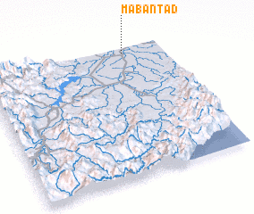 Places with similar names to Mabantad, Philippines :: Disclaimer :: Information on this page comes without warranty of any kind |
||
|
Where is Mabantad? Elevation and coordinates ::
Latitude (lat): 16°57'41"N Longitude (lon): 121°47'12"E
Elevation (approx.): 48m (map arrows pan, magnifying glasses zoom) |
||
|
Visiting Mabantad? Hotel/Accommodation ::
Book a hotel in Mabantad Travel Guide ::
Buy a travel guide for Philippines rental cars ::
car rental offers GPS waypoint ::
download a GPX waypoint (PoI) of Mabantad for your GPS receiver
|
||