|
search place name
|
||
Macaleeng (Pangasinan, Philippines)Macaleeng is a town in the Pangasinan region of Philippines. An overview map of the region around Macaleeng is displayed below.
regional and 3d topo map of Macaleeng, Philippines ::

Macaleeng airports ::
The nearest airport is BAG - Baguio, located 68.6 km east of Macaleeng.
Other airports nearby include MNL - Manila Ninoy Aquino Intl (223.7 km south east), Nearby towns ::
Sablig (0.5km north west) //
Auile (0.6km north) //
Ablang (2.2km west) //
Toritori (3.5km south) //
Santiago (3.8km south) //
Labrang (4.5km north west) //
Santa Rita (4.5km north west) //
Anda (4.7km north west) //
Pamaoran (5.3km south west) //
Tondol (5.8km north east) //
Ramites (6.2km north) //
Baranoy (6.2km north) //
Sabor (7.0km north west) //
Dolaoan (7.2km north) //
Baley-araan (7.2km south) //
Garita (7.2km north west) //
Pangapisam (7.6km south) //
Cabungan (7.7km north) //
Aweg (7.7km north west) //
San Miguel (8.2km north) //
Cayucay (8.3km south) //
Polo (8.5km south west) //
Wala (8.3km west) //
Pantal (8.6km north west) //
Lasip (8.5km north west) //
San Vicente (9.6km south west) //
[all distances 'as the bird flies' and approximate] 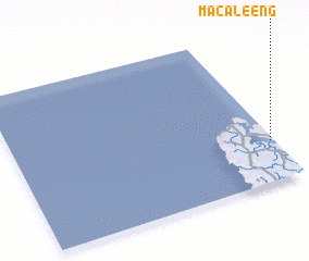 Places with similar names to Macaleeng, Philippines ::
// Mai-hka-long (MM)
// Maklang (MM)
// Maklang (MM)
// Maklang (MM)
// Maklang (MM)
// Maklang (MM)
// Maklang (MM)
// Māklāng (MM)
// Māklāng (MM)
// Mougoulounga (CM)
Disclaimer :: Information on this page comes without warranty of any kind |
||
|
Where is Macaleeng? Elevation and coordinates ::
Latitude (lat): 16°15'54"N Longitude (lon): 119°59'15"E
Elevation (approx.): 25m (map arrows pan, magnifying glasses zoom) |
||
|
Visiting Macaleeng? Hotel/Accommodation ::
Book a hotel in Macaleeng Travel Guide ::
Buy a travel guide for Philippines rental cars ::
car rental offers GPS waypoint ::
download a GPX waypoint (PoI) of Macaleeng for your GPS receiver
|
||