|
search place name
|
||
Mactan (Masbate, Philippines)Mactan is a town in the Masbate region of Philippines. An overview map of the region around Mactan is displayed below.
regional and 3d topo map of Mactan, Philippines ::

Mactan airports ::
The nearest airport is KLO - Kalibo, located 160.9 km west of Mactan.
Other airports nearby include TAC - Tacloban Daniel Z Romualdez (168.8 km south east), BCD - Bacolod (189.1 km south west), NOP - Masbate Mactan Cebu Intl (203.0 km south), ILO - Iloilo (206.8 km south west), Nearby towns ::
Arado (1.8km north east) //
Canuog-nuog (2.6km north west) //
Buenavista (5.1km north) //
Busñgalan (5.4km north) //
Malalin (5.9km north) //
Kandamal (6.1km north) //
Palobandera (6.3km south east) //
Pinangapogan (6.7km north east) //
Lumbia (7.6km north) //
Banga (7.7km north) //
Panicijan (7.8km north) //
Mongahay (8.0km south east) //
Dagosongan (8.5km west) //
Busay (8.7km north) //
Banajao (9.6km north east) //
Aguada (10.2km south west) //
Balocawe (10.6km north east) //
Salvacion (10.8km north east) //
Antipolo (10.8km north east) //
Arado (10.8km north east) //
Bontolan (10.8km north east) //
Crossing (10.8km north east) //
Intosan (10.8km north east) //
Maanahao (10.8km north east) //
Miabas (10.8km north east) //
Rizal (10.8km north east) //
Dimasalang (10.9km north east) //
[all distances 'as the bird flies' and approximate] 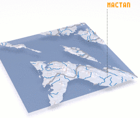 Places with similar names to Mactan, Philippines ::
Disclaimer :: Information on this page comes without warranty of any kind |
||
|
Where is Mactan? Elevation and coordinates ::
Latitude (lat): 12°7'54"N Longitude (lon): 123°46'48"E
Elevation (approx.): 54m (map arrows pan, magnifying glasses zoom) |
||
|
Visiting Mactan? Hotel/Accommodation ::
Book a hotel in Mactan Travel Guide ::
Buy a travel guide for Philippines rental cars ::
car rental offers GPS waypoint ::
download a GPX waypoint (PoI) of Mactan for your GPS receiver
|
||