|
search place name
|
||
Maghanoy (Cebu, Philippines)Maghanoy is a town in the Cebu region of Philippines. An overview map of the region around Maghanoy is displayed below.
regional and 3d topo map of Maghanoy, Philippines ::

Maghanoy airports ::
The nearest airport is NOP - Masbate Mactan Cebu Intl, located 54.9 km north east of Maghanoy.
Other airports nearby include BCD - Bacolod (86.7 km north west), DGT - Dumaguete (89.8 km south), ILO - Iloilo (125.2 km north west), SJI - San Jose Antique (187.6 km north west), Nearby towns ::
Barili (0.9km south west) //
Candugay (1.3km north east) //
Luhod (1.4km south east) //
Patupat (2.4km north east) //
Mantayupan (2.5km south west) //
Bolocboloc (2.6km south east) //
Japitan (2.6km north west) //
Cagay (2.8km north east) //
Budbod (3.5km south) //
Biaong (3.6km east) //
Dakit (3.6km east) //
Giloctog (3.7km north) //
Guibuangan (3.9km west) //
Cansitoy (4.1km south east) //
Pancil (4.9km south) //
Vito (5.2km north east) //
Taklob (5.2km south east) //
Kandiis (5.2km south east) //
Kanghumawd (5.2km south west) //
Tubod-Bitoon (5.2km south west) //
Minilos (5.2km south west) //
Maigang (5.5km south west) //
Balao (5.9km south) //
Binotongan (5.9km south) //
Tubod (5.8km east) //
Kanyuko (5.8km west) //
Bulak (5.9km south) //
Cambairan (6.1km south east) //
Ongca (6.1km south east) //
[all distances 'as the bird flies' and approximate] 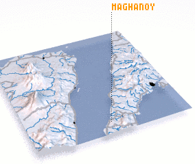 Places with similar names to Maghanoy, Philippines ::
Disclaimer :: Information on this page comes without warranty of any kind |
||
|
Where is Maghanoy? Elevation and coordinates ::
Latitude (lat): 10°7'0"N Longitude (lon): 123°31'0"E
Elevation (approx.): 27m (map arrows pan, magnifying glasses zoom) |
||
|
Visiting Maghanoy? Hotel/Accommodation ::
Book a hotel in Maghanoy Travel Guide ::
Buy a travel guide for Philippines rental cars ::
car rental offers GPS waypoint ::
download a GPX waypoint (PoI) of Maghanoy for your GPS receiver
|
||