|
search place name
|
||
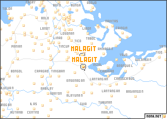
Malagit (Capiz, Philippines)Malagit is a town in the Capiz region of Philippines. An overview map of the region around Malagit is displayed below.
regional and 3d topo map of Malagit, Philippines ::
Malagit airports ::
The nearest airport is KLO - Kalibo, located 55.1 km north west of Malagit.
Other airports nearby include ILO - Iloilo (89.1 km south), BCD - Bacolod (91.8 km south), SJI - San Jose Antique (125.2 km south west), NOP - Masbate Mactan Cebu Intl (179.3 km south east), Nearby towns ::
Bailan (0.9km south west) //
Pontevedra (1.6km north) //
Yatingan (1.9km north) //
Alasaguing (1.8km west) //
Agdalipe (1.8km west) //
Sublangon (1.9km north west) //
Malag-it (2.5km south) //
Salgan (2.6km north west) //
Indayagan (2.6km north west) //
Palaguian (2.6km north west) //
Ñgalan (2.6km north west) //
Linampongan (2.6km north west) //
Piña (2.6km north west) //
San Pedro (2.6km north west) //
Quinatuyan (2.6km north west) //
Manayupit (2.6km north west) //
Solo (2.6km north west) //
Guimbialan (2.6km north west) //
Bungbungan (2.6km north west) //
Pardo (2.6km north west) //
Quinabunglan (2.6km north west) //
Parallan (2.6km north west) //
Hibaca (2.6km north west) //
Cabungahan (2.6km north west) //
Guba (2.6km north west) //
Banate (2.6km north west) //
Dulu-an (2.6km north west) //
Carataya (2.6km north west) //
Batabat (2.6km north west) //
[all distances 'as the bird flies' and approximate]  Places with similar names to Malagit, Philippines ::
Disclaimer :: Information on this page comes without warranty of any kind |
||
|
Where is Malagit? Elevation and coordinates ::
Latitude (lat): 11°28'0"N Longitude (lon): 122°50'0"E
Elevation (approx.): 7m (map arrows pan, magnifying glasses zoom) |
||
|
Visiting Malagit? Hotel/Accommodation ::
Book a hotel in Malagit Travel Guide ::
Buy a travel guide for Philippines rental cars ::
car rental offers GPS waypoint ::
download a GPX waypoint (PoI) of Malagit for your GPS receiver
|
||