|
search place name
|
||
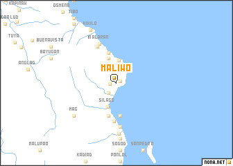
Maliwo (Southern Leyte, Philippines)Maliwo is a town in the Southern Leyte region of Philippines. An overview map of the region around Maliwo is displayed below.
regional and 3d topo map of Maliwo, Philippines ::
Maliwo airports ::
The nearest airport is TAC - Tacloban Daniel Z Romualdez, located 75.2 km north of Maliwo.
Other airports nearby include NOP - Masbate Mactan Cebu Intl (134.3 km west), DGT - Dumaguete (246.8 km south west), Nearby towns ::
Lawan (0.6km north east) //
Lagome (1.1km west) //
Agagan (2.0km south west) //
Odiong (2.0km south west) //
Talay (2.0km south west) //
Hingatungan (2.6km north) //
Hibatian (3.7km north) //
Silago (4.1km south) //
Bulac (4.2km north) //
Bagacay (4.2km north) //
Bantutoc (5.0km north) //
Bolbolon (5.3km south) //
Lunsuddaan (5.4km south) //
Sudmon (5.4km south) //
Sap-ang (6.2km south) //
Pangawilan (6.6km north west) //
Inalaran (6.8km north west) //
Badiangon (7.2km south) //
Awayon (8.2km south) //
Mag (8.5km south west) //
Kikilo (9.5km north west) //
[all distances 'as the bird flies' and approximate]  Places with similar names to Maliwo, Philippines ::
Disclaimer :: Information on this page comes without warranty of any kind |
||
|
Where is Maliwo? Elevation and coordinates ::
Latitude (lat): 10°33'51"N Longitude (lon): 125°10'41"E
Elevation (approx.): 42m (map arrows pan, magnifying glasses zoom) |
||
|
Visiting Maliwo? Hotel/Accommodation ::
Book a hotel in Maliwo Travel Guide ::
Buy a travel guide for Philippines rental cars ::
car rental offers GPS waypoint ::
download a GPX waypoint (PoI) of Maliwo for your GPS receiver
|
||