|
search place name
|
||
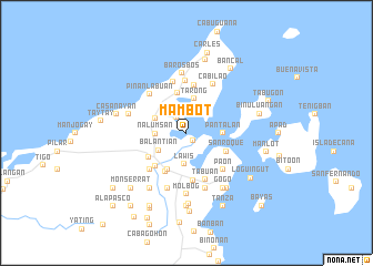
Mambot (Iloilo, Philippines)Mambot is a town in the Iloilo region of Philippines. An overview map of the region around Mambot is displayed below.
regional and 3d topo map of Mambot, Philippines ::
Mambot airports ::
The nearest airport is KLO - Kalibo, located 83.2 km west of Mambot.
Other airports nearby include BCD - Bacolod (97.0 km south), ILO - Iloilo (107.1 km south west), SJI - San Jose Antique (152.6 km south west), NOP - Masbate Mactan Cebu Intl (162.2 km south east), Nearby towns ::
Manhut (1.0km south east) //
Tupaz (1.8km north west) //
Nalumsan (3.1km west) //
Lawis (3.2km south) //
Balanti-an (3.2km south west) //
Bolo (3.4km north west) //
Tarong (3.5km north) //
Pantalan (3.6km east) //
Cawayan (4.1km north) //
Cabagohan (4.1km south west) //
Tingui-an (4.1km south west) //
San Roque (4.3km south east) //
Maayao (4.4km south west) //
Cubay (4.4km south west) //
Balasan (4.6km south west) //
Abong (4.8km north) //
Pani-an (4.8km south) //
Tabuan (5.0km south) //
Guinticgan (5.2km north) //
Panian (5.2km south east) //
Canuan (5.2km south east) //
Paon (5.2km south east) //
Calapdan (5.2km south east) //
Salvacion (5.2km south west) //
Mamhut Sur (5.2km south west) //
Bacolod (5.2km south west) //
Ipil (5.2km south west) //
Manacolod (5.2km south west) //
Camambugan (5.2km south west) //
[all distances 'as the bird flies' and approximate] 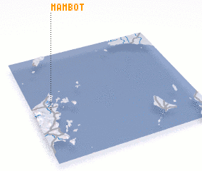 Places with similar names to Mambot, Philippines ::
Disclaimer :: Information on this page comes without warranty of any kind |
||
|
Where is Mambot? Elevation and coordinates ::
Latitude (lat): 11°30'0"N Longitude (lon): 123°7'0"E
Elevation (approx.): -32768m (map arrows pan, magnifying glasses zoom) |
||
|
Visiting Mambot? Hotel/Accommodation ::
Book a hotel in Mambot Travel Guide ::
Buy a travel guide for Philippines rental cars ::
car rental offers GPS waypoint ::
download a GPX waypoint (PoI) of Mambot for your GPS receiver
|
||