|
search place name
|
||
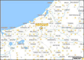
Manguin (Dagupan, Philippines)Manguin is a town in the Dagupan region of Philippines. An overview map of the region around Manguin is displayed below.
regional and 3d topo map of Manguin, Philippines ::
Manguin airports ::
The nearest airport is BAG - Baguio, located 46.5 km north east of Manguin.
Other airports nearby include MNL - Manila Ninoy Aquino Intl (182.7 km south east), Nearby towns ::
Salisi (0.0km north) //
Talisay (0.0km north) //
Tuh (0.0km north) //
Bolosan (1.3km north east) //
Caranglaan (1.6km west) //
Gabon (1.9km south) //
Bued (1.9km south) //
Talibaeo (1.9km south) //
Malabago (1.8km east) //
Salisay (1.9km north) //
San Miguel (1.8km west) //
Balani (1.8km west) //
Tubueng (1.8km west) //
Bonao (1.9km north) //
Ambonao (1.9km south east) //
Bued (2.6km south east) //
Nalsian (2.6km south west) //
San Sebastian (2.6km south west) //
Malabago (2.6km north east) //
Mayombo (2.6km north west) //
Calasiao (2.7km south) //
Anolid (2.8km north east) //
Dagupan (3.2km north west) //
Lasip (3.4km south) //
Lasip Grande (3.6km west) //
Lasip Chico (3.6km west) //
Pogo (3.6km west) //
Malued (3.6km west) //
Maasim (3.7km north) //
[all distances 'as the bird flies' and approximate]  Places with similar names to Manguin, Philippines ::
Disclaimer :: Information on this page comes without warranty of any kind |
||
|
Where is Manguin? Elevation and coordinates ::
Latitude (lat): 16°2'0"N Longitude (lon): 120°22'0"E
Elevation (approx.): 1m (map arrows pan, magnifying glasses zoom) |
||
|
Visiting Manguin? Hotel/Accommodation ::
Book a hotel in Manguin Travel Guide ::
Buy a travel guide for Philippines rental cars ::
car rental offers GPS waypoint ::
download a GPX waypoint (PoI) of Manguin for your GPS receiver
|
||