|
search place name
|
||
Manito (Albay, Philippines)Manito is a town in the Albay region of Philippines. An overview map of the region around Manito is displayed below.
regional and 3d topo map of Manito, Philippines ::

Manito airports ::
The nearest airport is KLO - Kalibo, located 227.6 km south west of Manito.
Other airports nearby include TAC - Tacloban Daniel Z Romualdez (244.9 km south east), Nearby towns ::
Balasbas (0.8km south) //
Kalaocalawan (0.8km south) //
Cauit (1.1km north) //
Buyo (1.5km south) //
Cogon (2.6km east) //
Naghaso (3.7km east) //
Tinapian (3.9km south west) //
Cavit (6.0km east) //
Punte de Jesus (7.9km east) //
Cawayan (9.2km south west) //
Pitogo (9.9km south west) //
Buenavista (10.7km south west) //
Bañog (11.0km south west) //
[all distances 'as the bird flies' and approximate] 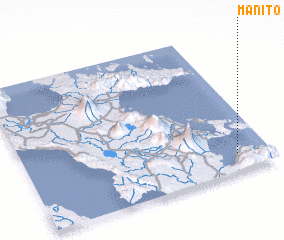 Places with similar names to Manito, Philippines ::
Disclaimer :: Information on this page comes without warranty of any kind |
||
|
Where is Manito? Elevation and coordinates ::
Latitude (lat): 13°7'26"N Longitude (lon): 123°52'2"E
Elevation (approx.): 25m (map arrows pan, magnifying glasses zoom) |
||
|
Visiting Manito? Hotel/Accommodation ::
Book a hotel in Manito Travel Guide ::
Buy a travel guide for Philippines rental cars ::
car rental offers GPS waypoint ::
download a GPX waypoint (PoI) of Manito for your GPS receiver
|
||