|
search place name
|
||
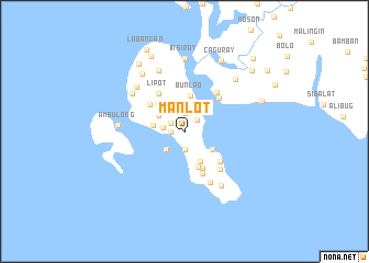
Manlot (Mindoro Occidental, Philippines)Manlot is a town in the Mindoro Occidental region of Philippines. An overview map of the region around Manlot is displayed below.
regional and 3d topo map of Manlot, Philippines ::
Manlot airports ::
The nearest airport is KLO - Kalibo, located 152.9 km south east of Manlot.
Other airports nearby include SJI - San Jose Antique (185.3 km south east), ILO - Iloilo (230.5 km south east), BCD - Bacolod (266.3 km south east), Nearby towns ::
Inasakan (1.4km west) //
Baong (1.6km north west) //
Monturidao (1.7km north east) //
Bule (1.9km north) //
Salumague (1.9km south) //
Manlukad (2.1km west) //
Bagokoy (2.6km south west) //
Bungkalan (3.0km north east) //
Undague (3.0km north west) //
Pagui (3.2km west) //
Natangdol (3.3km south east) //
Sapa (3.5km south east) //
Bunlao (3.7km north) //
Simerigan (3.9km south) //
Bankal (3.9km north west) //
Bunganbungan (4.1km south east) //
Singay (4.4km north west) //
Lipot (4.6km north west) //
Pauican (4.6km south) //
Tabai (4.7km south east) //
Carmen (4.9km north east) //
Santa Teresa (5.1km north east) //
Cabaong (5.2km south east) //
Maguirok (5.8km south east) //
Ilin (6.5km north west) //
Bunuaya (6.5km north west) //
Dunglas (6.6km south east) //
Ambulong (6.6km west) //
Ticod (6.7km north) //
[all distances 'as the bird flies' and approximate] 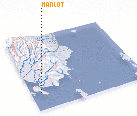 Places with similar names to Manlot, Philippines ::
// Mānloitaö (MM)
// Mān-loi-tau (MM)
// Mān Lū-taü (MM)
// Manalad (PH)
// Manlot (PH)
// Manlato (PH)
// Manlutay (PH)
// Manuelita (CU)
// Manuelita (CU)
// Manuelita (CU)
Disclaimer :: Information on this page comes without warranty of any kind |
||
|
Where is Manlot? Elevation and coordinates ::
Latitude (lat): 12°13'0"N Longitude (lon): 121°5'0"E
Elevation (approx.): 130m (map arrows pan, magnifying glasses zoom) |
||
|
Visiting Manlot? Hotel/Accommodation ::
Book a hotel in Manlot Travel Guide ::
Buy a travel guide for Philippines rental cars ::
car rental offers GPS waypoint ::
download a GPX waypoint (PoI) of Manlot for your GPS receiver
|
||