|
search place name
|
||
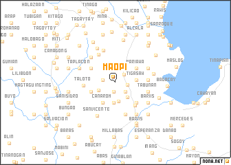
Maopi (Albay, Philippines)Maopi is a town in the Albay region of Philippines. An overview map of the region around Maopi is displayed below.
regional and 3d topo map of Maopi, Philippines ::
Maopi airports ::
The nearest airport is KLO - Kalibo, located 210.4 km south west of Maopi.
Other airports nearby include TAC - Tacloban Daniel Z Romualdez (251.6 km south east), Nearby towns ::
Abognan (1.5km south) //
Mamantao (1.9km north east) //
Anislag (1.9km east) //
Kinawitan (2.1km west) //
San Vicente (2.1km south east) //
Bascaran (2.8km north east) //
Panoypoy (2.9km south west) //
Mayon (3.1km south east) //
San Ramon (3.1km south) //
San Vicente (3.3km south) //
Banban (3.4km east) //
Tigasaw (3.4km east) //
Canarom (3.9km south west) //
Mariawa (4.1km north east) //
Barayong (4.1km north east) //
Florista (4.1km west) //
Pinaglaban (4.5km north west) //
Danlog (4.7km south east) //
Malabnig (4.7km south east) //
Villahermosa (4.9km south east) //
Taloto (5.1km west) //
Cotmon (5.3km north west) //
Agna (5.2km east) //
Lourdes (5.4km south) //
Tabunan (5.4km east) //
Inarado (5.5km north) //
Solong (5.6km north west) //
Ticotico (5.6km north east) //
Milaos (6.2km south east) //
[all distances 'as the bird flies' and approximate] 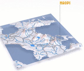 Places with similar names to Maopi, Philippines ::
Disclaimer :: Information on this page comes without warranty of any kind |
||
|
Where is Maopi? Elevation and coordinates ::
Latitude (lat): 13°4'47"N Longitude (lon): 123°41'8"E
Elevation (approx.): 90m (map arrows pan, magnifying glasses zoom) |
||
|
Visiting Maopi? Hotel/Accommodation ::
Book a hotel in Maopi Travel Guide ::
Buy a travel guide for Philippines rental cars ::
car rental offers GPS waypoint ::
download a GPX waypoint (PoI) of Maopi for your GPS receiver
|
||